Thanks, Mike! My state senator is one of the co-sponsors. Has anyone else noticed that some of us that disagree on many other issues seem to agree some of these conservation issues?Like it or not, this is essentially the guide for development in Pa.
And here is the recent Senate Resolution to review the code.

Senate Resolution 211 Information; 2025-2026 Regular Session - The Official Website of the Pennsylvania General Assembly
View the status of PA General Assembly bills including history, text, co-sponsorship memos, summaries, actions, fiscal notes, and statute references. Download legislation in HTML, PDF, or Word.www.palegis.us
Includes sponsor and the co-sponsers, which may interest some of you. Sponsor was from Berks Co.

You are using an out of date browser. It may not display this or other websites correctly.
You should upgrade or use an alternative browser.
You should upgrade or use an alternative browser.
Cornwall Warehouse
- Thread starter riverwhy
- Start date

So why are you posting "eminent domain" when there is no eminent domain involved?Not yet...
That hurts your position, rather than helping support it.
barrybarry
Well-known member
- Joined
- Feb 23, 2009
- Messages
- 509
I recently attended a local township board meeting. Apparently, all the local townships are working on zoning restrictions for Data centers. It's better to have existing restrictions before someone decides to build one.
I see Columbia Borough is taking some action.

 www.wgal.com
Council vote could take McGinness Park off the table for a data center in Lancaster County
The fate of McGinness Park in Columbia Borough is still up in the air as talks of a data center continue.
www.wgal.com

wildtrout2
Well-known member
Merely a suggestion of possible actions that could take place down the road. It's certainly not unheard of.So why are you posting "eminent domain" when there is no eminent domain involved?
That hurts your position, rather than helping support it.
What "position" do you refer to?
wildtrout2
Well-known member
In Burgin County Kentucky, City Council voted 3-2 on July 9th to advance an ordinance for "annexing" more than a 1000 acres tied to a pontential data center project. They get property one way or another.Merely a suggestion of possible actions that could take place down the road. It's certainly not unheard of.
This may be a proposed building operation that wouldn't create any noticeable negative environmental impacts.
I can't believe I wrote that.
But I can believe it's most likely the truth.
That whole area was my backyard and the Snitz Creek was my daily wade. I was allowed to walk to and fish one short "hole" in the Snitz Creek when I was 5 years old. It was only maybe - at the very most - 100 yards from my house which was along the edge of the village.
If adults were to come looking, they could easily see me and anyone else. It was a well-attended fishing hole/swimming hole/slag rock throwing hole. But quiet and calm most of the time and an easy walk home for food and bathroom.
It became my focus and catalyst for everything.
Even if I really didn't want to, I made myself go to the creek every day.
I grew up there.
I learned about life from the Snitz Creek and the watershed and surrounding lands.
I walked and examined pretty much all the land in and surrounding Cornwall.
I learned and lived how the water flowed and people lived and the farms and cows were milked and corn was grown and trout lived, how to trap and hunt and learn about all the other fish and crustaceans and insects, etc.
During my time, mining was active, and mining wealth and regrown natural health were not in big public battle, locally. Ignorance by individuals, as always, was the battle.
The wealthy flyfished.
They at least wanted a private flyfishing club on some limestone water and that meant healthy headwaters and streambanks.
A Cornwall "sportsman's club" bred and raised their own trout from a large stone spring house.
It was a large spring that provided water for the ultra-wealthy who originally owned/lived there.
From purchased trout, my neighbor and surrogate uncle collected the eggs and milt stripped and mixed and placed in baskets suspended in the upward boil of the spring water within the stone spring house structure. The young were raised in a raceway and then retained in a spring pond and stocked into the Snitz in sections that the club had created with banks reinforced with log wall structures and heavy iron pins.
During my tenure as creek creature, the sportsmen stopped fishing, but I was permitted to rebuild and redesign and come up with new and different structures in the stream and come up with different considerations for everything that is connected.
(E.g., tried to link bank plants to mayflies and other aquatics for various needs. Such as trying to see if Blue Winged Olive's actually do prefer smaller leaved bank bushes for landing sites after emerging, etc.)
But that is the past.
And the flow is much less and the access very little. Except for what little time I have spent on the lower section Snitz at the city sewer facility, where TU work was performed on the Snitz, I know nothing about its current state of health and its species.
Everything has changed. Every tract of land, every farm, woodlot, etc., subdivided and subdivided and rezoned with little public knowledge or attention, especially since local newspapers don't exist to inform.
But two things offered for consideration:
1. The volume of flow of the Snitz coming from the Open Pit (the body of water near the proposed structure is the flooded iron ore mine) is almost insignificant to what it had been prior to all the more recent residential landscaping and divergence.
2. Growing up there I learned that Cornwall is and was a very thoroughly industrialized piece of geology and geography.
The entire area was completely affected by man-made changes. Farmland immediately adjacent to the mining operations were preserved and cared for and fed the miners and others. As well most of the farmland up and down the valley.
The wealthy owners' residential properties and greenhouses and beef farms and other operations were beautified and preserved up until the late 1970s, when management of some of the upper Snitz property fell into the wrong hands. (The now deceased manager trashed it and destroyed it, sold off pieces of buildings and etc., but that was the beautiful landscape and the headwaters that began the top of a wild brown trout population that should be expected to still exist in some degree downstream.)
Because of it being an industrial mining land area, it was never a surprise to discover the degree and vast amount of total geological and land management changes that had been done to the immediate area.
Almost everything was altered.
But during the 1950s up through the 1970s, wildlife was recovering.
That's all gone. Since the 1980s, but especially during the 1990s up through the 2000s till now and ESPECIALLY now, the subdivision and capitalizing and financial competitions and unknown investors and unexpected wealth of investments has destroyed the environmental health and wildlife of Cornwall.
Cornwall is no longer anything rural.
All that said and more not said, IMO it doesn't seem this proposed project will present an environmental problem and no bad direct effects to the Snitz.
(Unless any changes would have to be made to water or sewer lines that run from Cornwall down the Snitz flood plain into Lebanon City.)
The proposed structure location and its environmental impact actually do not seem unreasonable. The proposed site is essentially made of extracted and moved materials from the mine. It is upslope of the Open Pit and from the engineer's proposed plan my knowledge is that access to the property would be coming from Rt. 322 down a short distance and back a fairly long lane. Traffic shouldn't be that affected.
It should probably be somewhat isolated.
It is property that used to be considered part of the Open Pit operations. It was locally hunted sometimes for deer, squirrel and grouse, but never was a good hunting area. But in the years since the mines shut down and left the state, some evolving community leadership was able to extract great amounts of wealth dealing with Cornwall properties and possession since the mines closed. This property was part of that land/profit management dealings but just a minor portion.
Here's the engineer's proposal plan.
I can't believe I wrote that.
But I can believe it's most likely the truth.
That whole area was my backyard and the Snitz Creek was my daily wade. I was allowed to walk to and fish one short "hole" in the Snitz Creek when I was 5 years old. It was only maybe - at the very most - 100 yards from my house which was along the edge of the village.
If adults were to come looking, they could easily see me and anyone else. It was a well-attended fishing hole/swimming hole/slag rock throwing hole. But quiet and calm most of the time and an easy walk home for food and bathroom.
It became my focus and catalyst for everything.
Even if I really didn't want to, I made myself go to the creek every day.
I grew up there.
I learned about life from the Snitz Creek and the watershed and surrounding lands.
I walked and examined pretty much all the land in and surrounding Cornwall.
I learned and lived how the water flowed and people lived and the farms and cows were milked and corn was grown and trout lived, how to trap and hunt and learn about all the other fish and crustaceans and insects, etc.
During my time, mining was active, and mining wealth and regrown natural health were not in big public battle, locally. Ignorance by individuals, as always, was the battle.
The wealthy flyfished.
They at least wanted a private flyfishing club on some limestone water and that meant healthy headwaters and streambanks.
A Cornwall "sportsman's club" bred and raised their own trout from a large stone spring house.
It was a large spring that provided water for the ultra-wealthy who originally owned/lived there.
From purchased trout, my neighbor and surrogate uncle collected the eggs and milt stripped and mixed and placed in baskets suspended in the upward boil of the spring water within the stone spring house structure. The young were raised in a raceway and then retained in a spring pond and stocked into the Snitz in sections that the club had created with banks reinforced with log wall structures and heavy iron pins.
During my tenure as creek creature, the sportsmen stopped fishing, but I was permitted to rebuild and redesign and come up with new and different structures in the stream and come up with different considerations for everything that is connected.
(E.g., tried to link bank plants to mayflies and other aquatics for various needs. Such as trying to see if Blue Winged Olive's actually do prefer smaller leaved bank bushes for landing sites after emerging, etc.)
But that is the past.
And the flow is much less and the access very little. Except for what little time I have spent on the lower section Snitz at the city sewer facility, where TU work was performed on the Snitz, I know nothing about its current state of health and its species.
Everything has changed. Every tract of land, every farm, woodlot, etc., subdivided and subdivided and rezoned with little public knowledge or attention, especially since local newspapers don't exist to inform.
But two things offered for consideration:
1. The volume of flow of the Snitz coming from the Open Pit (the body of water near the proposed structure is the flooded iron ore mine) is almost insignificant to what it had been prior to all the more recent residential landscaping and divergence.
2. Growing up there I learned that Cornwall is and was a very thoroughly industrialized piece of geology and geography.
The entire area was completely affected by man-made changes. Farmland immediately adjacent to the mining operations were preserved and cared for and fed the miners and others. As well most of the farmland up and down the valley.
The wealthy owners' residential properties and greenhouses and beef farms and other operations were beautified and preserved up until the late 1970s, when management of some of the upper Snitz property fell into the wrong hands. (The now deceased manager trashed it and destroyed it, sold off pieces of buildings and etc., but that was the beautiful landscape and the headwaters that began the top of a wild brown trout population that should be expected to still exist in some degree downstream.)
Because of it being an industrial mining land area, it was never a surprise to discover the degree and vast amount of total geological and land management changes that had been done to the immediate area.
Almost everything was altered.
But during the 1950s up through the 1970s, wildlife was recovering.
That's all gone. Since the 1980s, but especially during the 1990s up through the 2000s till now and ESPECIALLY now, the subdivision and capitalizing and financial competitions and unknown investors and unexpected wealth of investments has destroyed the environmental health and wildlife of Cornwall.
Cornwall is no longer anything rural.
All that said and more not said, IMO it doesn't seem this proposed project will present an environmental problem and no bad direct effects to the Snitz.
(Unless any changes would have to be made to water or sewer lines that run from Cornwall down the Snitz flood plain into Lebanon City.)
The proposed structure location and its environmental impact actually do not seem unreasonable. The proposed site is essentially made of extracted and moved materials from the mine. It is upslope of the Open Pit and from the engineer's proposed plan my knowledge is that access to the property would be coming from Rt. 322 down a short distance and back a fairly long lane. Traffic shouldn't be that affected.
It should probably be somewhat isolated.
It is property that used to be considered part of the Open Pit operations. It was locally hunted sometimes for deer, squirrel and grouse, but never was a good hunting area. But in the years since the mines shut down and left the state, some evolving community leadership was able to extract great amounts of wealth dealing with Cornwall properties and possession since the mines closed. This property was part of that land/profit management dealings but just a minor portion.
Here's the engineer's proposal plan.
wildtrout2
Well-known member
Thanks for taking the time to write that informative post. Must have been fun growing up there. Ahh, the good ole days.
Last edited:
barrybarry
Well-known member
- Joined
- Feb 23, 2009
- Messages
- 509
Thanks for your post.I grew up there.
I learned about life from the Snitz Creek and the watershed and surrounding lands.
I did the same in the late 60's and early 70's. Muskrat trapping/swimming/fishing /camping out with my friends - it was a damn fine time that I often think about. We hung out in the area around Oak Street. We rode our bikes a couple of miles to get there.
I almost cried when I saw the size of the stream a few years ago. It was about half of the size it was years ago. I remember the depth and size of the creek. When you're 12 and standing in hip boots, depth matters.
It saddens me that the Snitz is no longer the stream that it once was.
I didn't include the following info about the relationship of the water in the "lake" and different entities.
The Open Pit was sold to Elizabethtown so the headwaters of the Snitz Creek could be diverted into the Conewago Creek. The connection of watersheds is very close to the mine. Walking distance. I did it many times. With the extra flow of water in the Conewago Creek, a major water source for Elizabethtown in Lancaster County, Elizabethtown became eligible for additional housing development. Otherwise, Elizabethtown didn't have enough water for farm-flipper businesses to build more ticky tacky.
The flow from the Snitz is visible in the recreational Mt. Gretna lake as the Snitz water shoots up through the surface of the lake and flows when the lake is lowered to minimize bank growth. from the pipes.
The current status of control and ownership of the Open Pit I have not verified, but the entire property was originally offered to the borough for $1.
The borough council president turned down the offer. He said he refused the offer because the water in the Open Pit was polluted from PCBs.
If he hadn't turned down the offer and instead allowed the council to debate and decide, the property would very likely be borough property. At least for a little while.
That council president, very politically active, also helped sell off the borough's watershed and later cooperated with other "farm flippers" and to eliminate its use of the Snitz and Hammer Creeks and instead depend on Lebanon City residential water supply and treatment.
That council president went on to become a top county leader and known as a strong Republican supporter.
Otherwise, the entire watershed properties (borough and city) providing upper beginnings for the Snitz, Quittapahilla, Hammer and Conewago creeks would be public properties and probably protected instead of revised into capitalizing as it has been.
(If the borough would have stayed on its original rules of housing - larger tracts and on-lot sewage - it would be very, very valuable today. Any further residential build was prevented because the borough reached its limit for sewage treatment and could only expand if that changed. The value today would be expected to be great because of the lower density, lower taxes, rural atmosphere and close proximity to some of the major roads through the state and other, i.e. the Pa. Turnpike and Routes 72 and 322. The very close proximity of this proposed large distribution building and operation to Rt. 322 instead of entering any further through the borough minimizes impacts to residents. While most who performed all the changes of the Cornwall Borough became very wealthy, they are deceased. Almost all. Won't be long before all have passed. This is their life work.)
The Open Pit was sold to Elizabethtown so the headwaters of the Snitz Creek could be diverted into the Conewago Creek. The connection of watersheds is very close to the mine. Walking distance. I did it many times. With the extra flow of water in the Conewago Creek, a major water source for Elizabethtown in Lancaster County, Elizabethtown became eligible for additional housing development. Otherwise, Elizabethtown didn't have enough water for farm-flipper businesses to build more ticky tacky.
The flow from the Snitz is visible in the recreational Mt. Gretna lake as the Snitz water shoots up through the surface of the lake and flows when the lake is lowered to minimize bank growth. from the pipes.
The current status of control and ownership of the Open Pit I have not verified, but the entire property was originally offered to the borough for $1.
The borough council president turned down the offer. He said he refused the offer because the water in the Open Pit was polluted from PCBs.
If he hadn't turned down the offer and instead allowed the council to debate and decide, the property would very likely be borough property. At least for a little while.
That council president, very politically active, also helped sell off the borough's watershed and later cooperated with other "farm flippers" and to eliminate its use of the Snitz and Hammer Creeks and instead depend on Lebanon City residential water supply and treatment.
That council president went on to become a top county leader and known as a strong Republican supporter.
Otherwise, the entire watershed properties (borough and city) providing upper beginnings for the Snitz, Quittapahilla, Hammer and Conewago creeks would be public properties and probably protected instead of revised into capitalizing as it has been.
(If the borough would have stayed on its original rules of housing - larger tracts and on-lot sewage - it would be very, very valuable today. Any further residential build was prevented because the borough reached its limit for sewage treatment and could only expand if that changed. The value today would be expected to be great because of the lower density, lower taxes, rural atmosphere and close proximity to some of the major roads through the state and other, i.e. the Pa. Turnpike and Routes 72 and 322. The very close proximity of this proposed large distribution building and operation to Rt. 322 instead of entering any further through the borough minimizes impacts to residents. While most who performed all the changes of the Cornwall Borough became very wealthy, they are deceased. Almost all. Won't be long before all have passed. This is their life work.)
Last edited:

I knew the Etown water came from the quarry but had no ideal it was done by way of Conewago Creek and that it entered Mount Gretna Lake. If it has pcb’s how can it be a water source for Etown. Is the lake water declining and is that why Snitz flow is declining? Is any kind of fishing or boating done in the lake?
The PCB contamination was a hoax. For real. The borough council just accepted the claim. They didn't know.
My neighbor who bred trout in the spring house worked for the mining company and designed some equipment and other aspects for mining and stabilizing the shafts, etc. He told me that any engines containing any PCBs were deep into the shafts and flooded and not likely to have any effect. The PCB claim was a way to have the property divided up among some of the top political party/legal operatives. Despite some having known misbehavior and being criticized by judges for some of their actually illegal activities, the group took over all the property and it became their property.
Some of us fantasized that it would become a host for lake trout and hybrid stripers and trout and whatever other prey fish species. That thing is deep! Deeper than most lakes and bays. When the snow geese started migrating into it and access was easy, it just seemed it would be a really healthy environment and recreational place. Scuba divers commonly used abandoned quarries in this area. There's a flooded old quarry in Richland along the Tulpehocken Creek were a trout hatchery/recreational fishing business exists in the space between the quarry and the creek. So, it seemed reasonable that area leadership with political power would do something to benefit the population. But it didn't happen. Personal wealth gain was the obvious, indisputable goal.
(The same hierarchy somehow never revealed what happened to a warehouse full of Michter's Whiskey barrels and other whiskey containers when the distillery business suddenly stopped in 1990 and was abandoned. Here's a posted article about the situation. The actual thieves were never discovered. What a poor result from any government investigations, the results of which were never revealed. Occasionally, someone would show me or I would see a bottle gifted to them from the same people.)
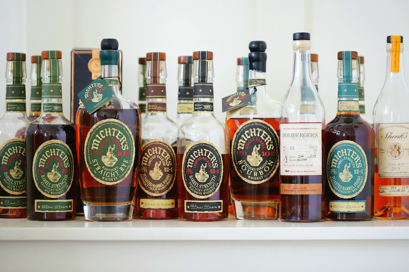
 thebourbonculture.com
My neighbor who bred trout in the spring house worked for the mining company and designed some equipment and other aspects for mining and stabilizing the shafts, etc. He told me that any engines containing any PCBs were deep into the shafts and flooded and not likely to have any effect. The PCB claim was a way to have the property divided up among some of the top political party/legal operatives. Despite some having known misbehavior and being criticized by judges for some of their actually illegal activities, the group took over all the property and it became their property.
Some of us fantasized that it would become a host for lake trout and hybrid stripers and trout and whatever other prey fish species. That thing is deep! Deeper than most lakes and bays. When the snow geese started migrating into it and access was easy, it just seemed it would be a really healthy environment and recreational place. Scuba divers commonly used abandoned quarries in this area. There's a flooded old quarry in Richland along the Tulpehocken Creek were a trout hatchery/recreational fishing business exists in the space between the quarry and the creek. So, it seemed reasonable that area leadership with political power would do something to benefit the population. But it didn't happen. Personal wealth gain was the obvious, indisputable goal.
(The same hierarchy somehow never revealed what happened to a warehouse full of Michter's Whiskey barrels and other whiskey containers when the distillery business suddenly stopped in 1990 and was abandoned. Here's a posted article about the situation. The actual thieves were never discovered. What a poor result from any government investigations, the results of which were never revealed. Occasionally, someone would show me or I would see a bottle gifted to them from the same people.)
Michter's Distillery: Past, Present and Future - Bourbon Culture
The story of Michter's Distillery, America's most turbulent whiskey brand. Click here to get the full story on this historic brand.
thebourbonculture.com

rancid waders
Well-known member
They don't let you fish. Former resident
rancid waders
Well-known member
They got excited when someone noticed me practicing spey casting
the PCB hoax is starting to ring a bell to me now. You confirm what I generally remembered about the corrupt actors there. Does the lake feed Snitz directly or indirectly? The farthest upstream I remember seeing it flow was close by the Historic Site. I even remember participating in a stealth stocking of 5 inch rainbows authorized by a Sportsman’s Club back in the 90’s. How were the temperatures historically in the upper reaches. That is where we dumped the fish. Any history of Brookies? We fished the maybe 1/4 mile stretch upstream and downstream during the early 90s. I remember some decent sulphur hatches back then. We caught some browns and bows in that stretch.

salmo
Well-known member
My 2 Cents here. I hate that the township approved the project from an environmental stand. Also, I know nothing about the application for the project. But ..... the issue may be in the township zoning ordinance and plan. If the land was zoned for warehouses, then unfortunately the developer is entitled to an approval by law. The heavy work for the environmentalists needs to be done when the zone plan is adopted.
“The first thing we do is, let’s kill all the lawyers.” It’s said by a character called **** the Butcher in Act IV, Scene II of William Shakespeare’s Henry VI, Part II.
“The first thing we do is, let’s kill all the lawyers.” It’s said by a character called **** the Butcher in Act IV, Scene II of William Shakespeare’s Henry VI, Part II.
Never found any native brookies.
Not that I can verify for absolute.
Historically, for many, many years the Snitz Creek stream bed was completely altered and small mill dams built. All the way downstream for at least a couple miles.
I pretty much lived in and along the stream and all the lands and fields.
I regularly drank from three springs and caught and identified the other fish - chubs, chub suckers, Johnny Darters, white suckers ...
The trout were wild browns and stocked trout. The ones bred by my neighbor wouldn't stay. His came from rainbows from the West Coast. Beautiful. But they would work their way downstream day to day and then disappear. The stocked trout I would catch and keep in a hidden "well". It was a several foot deep stone circle with spring seepage water. The rest of the community didn't know it was there for years, until the brush hiding it was destroyed by a homeless guy.
After Mother's Day I would restock the trout I kept hidden. I would put them in sections where I built structure, etc. I would catch and release.
I once found one brookie about 5 inches that I took for being a native, but it wasn't in the main stream Snitz. It was in a small stream that flowed into the Snitz just upstream of Rt. 72 bridge.
It was the only one I found.
That stream flowed from a dam of a small lake that was on the former Amalgamated Clothing Workers Union of America property, adjacent to the mine lands and part of the original mine owner family's property. There's a mansion there that was recently restored for several million*.
The guys who turned down the offer of $1 for the entire mine company property changed its zoning and solicited potential buyers of the lands. Community housing and other now occupies the area.
Much of the land below the Open Pit has been changed.
As a journalist, while I was reporting on changes being made and ownership changing, I was asked if I would be interested in managing the Snitz in the upper stretch at the historic foundry area and teach retirement community people how to fish. I turned it down.
But as a kid growing up in the Snitz and its small branches, I did learn how to hand catch spawning suckers as they would come upstream, as well chubs and trout. It was and I'm certain still is a fun activity. Hand catch and release. Even if it is technically illegal, I suppose. But it strongly helped with understanding what fish and wild trout want for a good "pool".
I would/could hand catch in small streams.
Haven't done it for a while, but ...
*https://www.aldenvilla.com/
Not that I can verify for absolute.
Historically, for many, many years the Snitz Creek stream bed was completely altered and small mill dams built. All the way downstream for at least a couple miles.
I pretty much lived in and along the stream and all the lands and fields.
I regularly drank from three springs and caught and identified the other fish - chubs, chub suckers, Johnny Darters, white suckers ...
The trout were wild browns and stocked trout. The ones bred by my neighbor wouldn't stay. His came from rainbows from the West Coast. Beautiful. But they would work their way downstream day to day and then disappear. The stocked trout I would catch and keep in a hidden "well". It was a several foot deep stone circle with spring seepage water. The rest of the community didn't know it was there for years, until the brush hiding it was destroyed by a homeless guy.
After Mother's Day I would restock the trout I kept hidden. I would put them in sections where I built structure, etc. I would catch and release.
I once found one brookie about 5 inches that I took for being a native, but it wasn't in the main stream Snitz. It was in a small stream that flowed into the Snitz just upstream of Rt. 72 bridge.
It was the only one I found.
That stream flowed from a dam of a small lake that was on the former Amalgamated Clothing Workers Union of America property, adjacent to the mine lands and part of the original mine owner family's property. There's a mansion there that was recently restored for several million*.
The guys who turned down the offer of $1 for the entire mine company property changed its zoning and solicited potential buyers of the lands. Community housing and other now occupies the area.
Much of the land below the Open Pit has been changed.
As a journalist, while I was reporting on changes being made and ownership changing, I was asked if I would be interested in managing the Snitz in the upper stretch at the historic foundry area and teach retirement community people how to fish. I turned it down.
But as a kid growing up in the Snitz and its small branches, I did learn how to hand catch spawning suckers as they would come upstream, as well chubs and trout. It was and I'm certain still is a fun activity. Hand catch and release. Even if it is technically illegal, I suppose. But it strongly helped with understanding what fish and wild trout want for a good "pool".
I would/could hand catch in small streams.
Haven't done it for a while, but ...
*https://www.aldenvilla.com/
Last edited:
Yeah. It was the one coming down through the Riding Club! It got messed up 1980s when the Union Center was sold and a loop of homes was built upstream of the creek from Rt. 419 before it gets to the Riding Club. I deliberately don't look at the area anymore.Neat history. Thanks for sharing! Is that trib you mentioned the one that flows through the Quentin Riding Club? That was spring fed but very silty at least in the 90s. I think there was a trout nursery there at one time.
I can imagine the stormwater from that loop of houses has messed up that creek. Downstream there are two limestone made ponds that used to commonly have fountains and trout were raised there during a period.
The only other trout were the ones raised at the springhouse.
And now that they sold the Riding Club, I don't want to look where it was.



USGS Stream Gauges