
Fly Fishing Northwest Pennsylvania:Steelhead Alley
An introduction to Northwest Pennsylvania’s inland trout streams and Lake Erie steelhead tributaries, from spring trout fishing to the fall steelhead run.
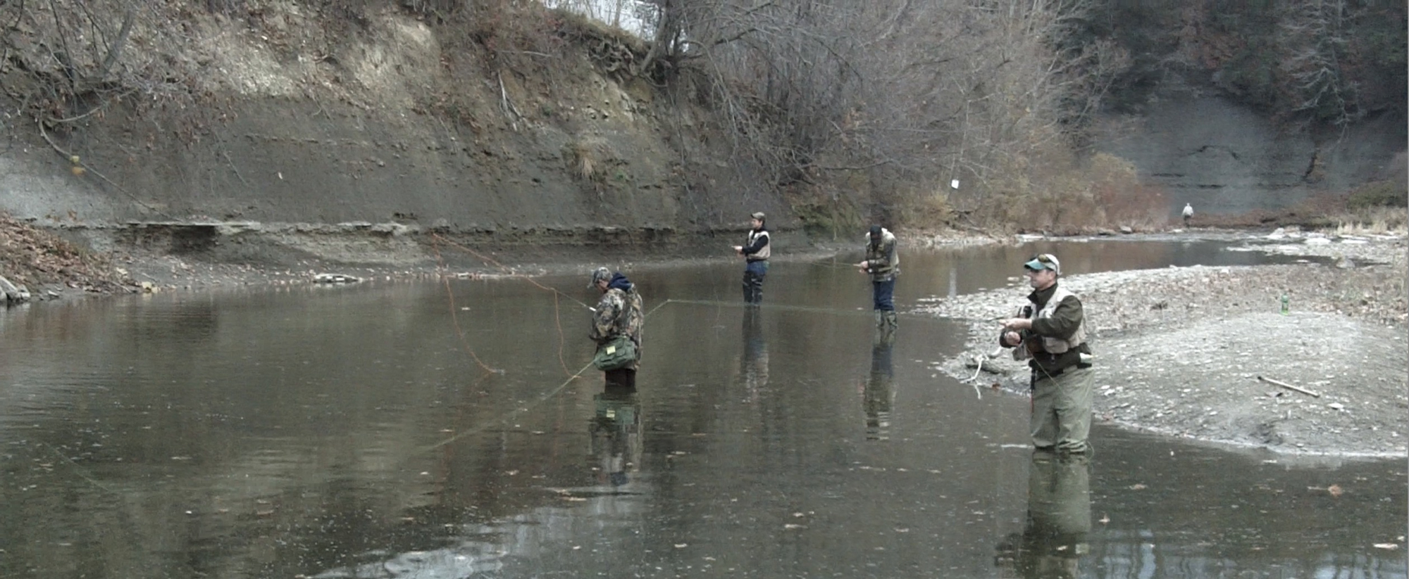
Northwest Pennsylvania’s Steelhead Alley brings together Lake Erie tributaries, where hard-fighting steelhead return from the lake from fall into spring, and traditional inland trout streams. Across nine counties, anglers can fish stocked and wild trout waters in spring, then turn toward the lake’s tributaries as steelhead begin moving upstream in fall.
What makes Steelhead Alley different
Northwest Pennsylvania offers more than one kind of trout fishing. Inland, streams such as Oil Creek, Neshannock Creek, and Tionesta Creek wind through wooded hills and rural communities. The PFBC stocks designated sections, while other waters in the region support wild trout. Oil Creek and Neshannock Creek also have sections under special regulations. State parks, game lands, and forests add places to explore, though anglers still need to check access and the rules for each stretch of water. Spring brings the familiar trout season, and some stocked waters get another round of fish in the fall. Then the focus turns toward Lake Erie.
Pennsylvania’s Lake Erie tributaries host a significant steelhead fishery supported by annual PFBC stockings of lake-run rainbow trout (Oncorhynchus mykiss). These fish grow in the lake, then enter tributary streams from fall into early spring. Runs often build from late October through December as rain raises stream levels and draws fresh fish upstream into creeks such as Walnut, Elk, and Conneaut. In January and February, cold water, slush, and shelf ice can make fishing tougher. Steelhead may hold in deeper, slower pools until a thaw improves conditions.
During the run, rainfall and streamflow have a lot to say about where fish move and how well anglers can see them. Rain or early-season snowmelt can bring fresh fish into the tributaries, but a creek may be too high to fish at first. As the water drops and begins to clear, egg patterns and nymphs can be effective. During a prolonged dry spell, the creeks can become low and gin-clear. Fish may gather in the deeper pools, where a quieter approach helps avoid spooking them.
The steelhead experience can get crowded, both on the stream and in the parking areas. Planning where you can access a creek is just as important as choosing which tributary to fish. Weather can make a good day better, but don’t wait for perfect water conditions. Check the creek, find a place you can fish, and give it a go.
Geography of Northwest Pennsylvania
Northwest Pennsylvania has two distinct landscapes. Along Lake Erie, a low, gently rolling plain gives rise to short streams that flow north into the lake, mainly through Erie County and a small part of Crawford County. Inland, the Appalachian Plateau is hillier. Streams wind through rounded uplands and valleys, with much of the water flowing toward the Allegheny and Ohio rivers. Glaciers crossed the northern part of the region more than once, leaving deposits that helped shape its lakes, wetlands, and drainage patterns.
Those differences remain visible in how the land is used. Farms, towns, woods, and wetlands share the gentler country near Lake Erie and in Crawford County. Erie is Pennsylvania’s fifth-largest city, with about 92,000 residents. Farther inland, larger stretches of forest cover the hills and river valleys, and towns are smaller and farther apart. Oil Creek adds another layer to the landscape’s history. Edwin Drake’s 1859 well south of Titusville helped launch an oil boom that brought wells, settlements, and transport routes into the valley. Its hillsides are largely wooded today, and Oil Creek State Park preserves traces of that early industry.
Explore Northwest trout and steelhead water
This map shows the audited Class A Wild Trout, Stocked Trout Waters, Special Regulation Areas, and Wilderness Trout Streams layers within the approved nine-county Northwest boundary.
The interactive map is loading. If it does not appear, use the Stream Conditions page instead.
Hatches worth watching
Caddis are a good place to start on Northwest trout streams. Paflyfish reports describe Grannoms on Oil Creek in April and caddis activity on Caldwell Creek and Neshannock Creek. Other caddis can follow through late spring and early summer, but the timing and strength of a hatch change with the weather and the water.
Sulphurs and Light Cahills add to the late-spring and early-summer fishing. Anglers have reported sulphurs on Oil Creek and a mix of sulphurs, caddis, and cream-colored Cahills on Neshannock Creek. Some of the best activity may come later in the day, so it pays to watch the water into the evening rather than assume the hatch is over when the afternoon slows down.
Blue-Winged Olives and midges round out the flies in your box worth carrying for this region, especially when larger spring insects are absent. These are starting points, not a fixed calendar for every stream. Check recent local reports, look for insects on the water, and adjust the fly to what the trout are actually eating.
For a broader look at seasonal timing around Pennsylvania, start here: Pennsylvania Hatch Chart — Complete Fly Fishing Guide by Month.
Stream conditions right now
These gauges are a good place to start when you are deciding where to go. They are a limited reference point; check the Paflyfish Stream Conditions page for a more complete listing.
| Station Name | Gage Ht (ft) | Discharge (cfs) | Trend (2hr) |
|---|