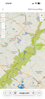
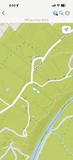
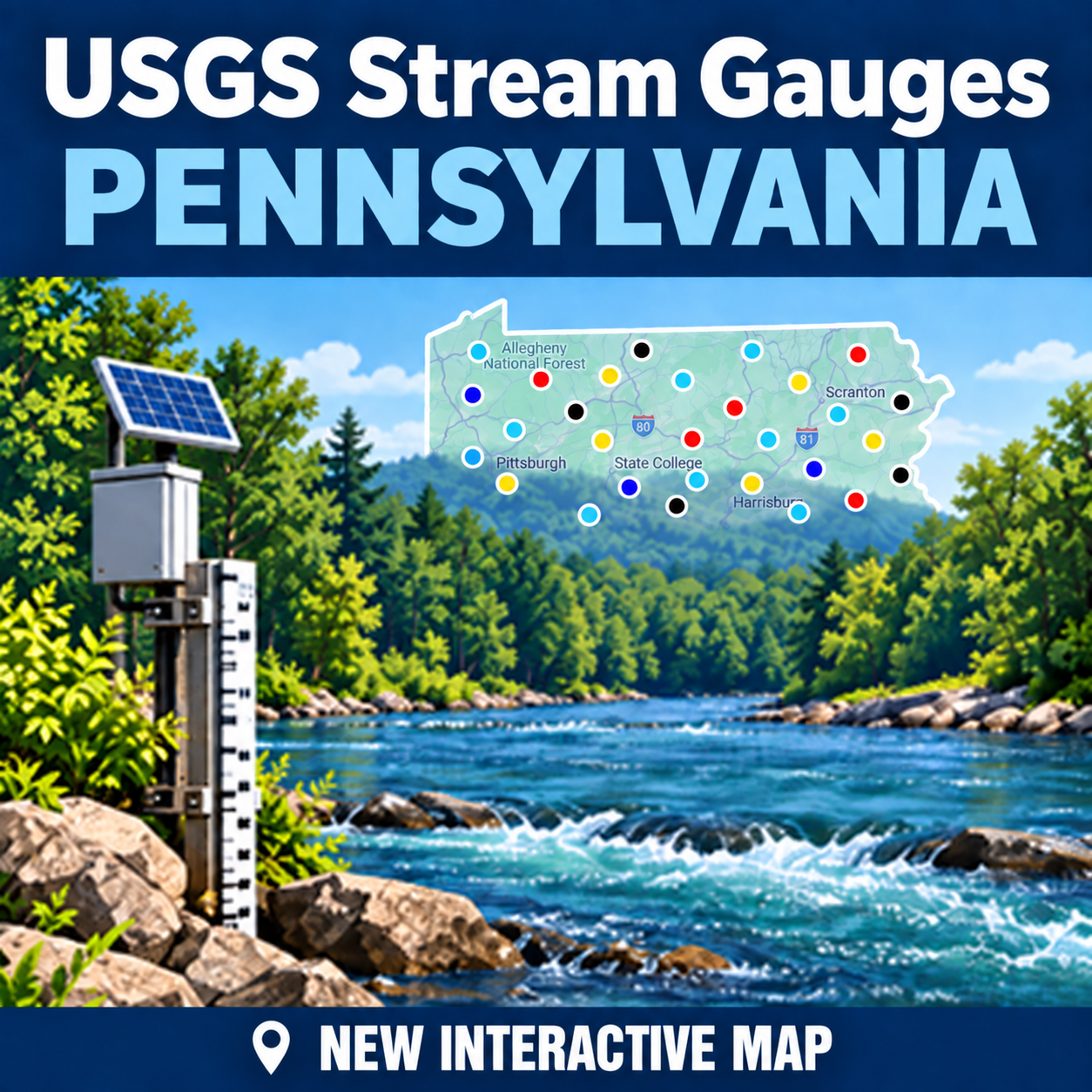
New: enhanced/navigable pa public fishing map

I added marked springs, because, why not. Area around the Jam displayed.
IMG_6986.jpeg
 
Last edited:
My pleasure.

Have you tried the arcgis app and the link I posted?

If you wouldn’t mind testing that out to make sure the navigation works I’d appreciate it. It’s flawless for me, but I can’t be sure it’s cool until at least a few someones give it a try. Thx!
The link you posted is just for navigation only and not showing stream classes, stocking, parking, etc that we would normally see on the ARC Gis map you initially posted?

I took a look around in ARCGis map and it works pretty well! Well done!!! I just started playing with Trout Routes (based from a friend's recommendation for scouting). I figured out quickly to check my Spartan Forge also. I use that app for hunting in addition to my Garmin GPS.
 
  • Like
Reactions: Kms
The arcgis maps for the WEB are great, and the map I posted has many useful details that none of the mobile apps I’ve tried include (fishbrain, troutroutes, onx hunt, onwater, and few others i can’t remember). The maps always display stream names and feature far more streams, stream information, public trails, gameland roads, and both verified and potential parking locations.

However, after a month of regular use, I’ve concluded that the current arcgis fields maps APP is a DISASTER. It launches background activities that cannot be disabled that render both itself and MANY other apps my iPhone 16 Pro Max nearly unusable. This has apparently been known for almost a year since version 25.2 was released (current is v26.1.2), but unfortunately arcgis doesn’t seem in any great hurry to fix it.

I have a nearly 10 year old iPad Pro that works perfectly because it won’t update past v25.1, so if you happen to have one of those go for it. Otherwise, skip the APP. So much for navigable maps. 🤦🤷

 
The arcgis maps for the WEB are great, and the map I posted has many useful details that none of the mobile apps I’ve tried include (fishbrain, troutroutes, onx hunt, onwater, and few others i can’t remember). The maps always display stream names and feature far more streams, stream information, public trails, gameland roads, and both verified and potential parking locations.

However, after a month of regular use, I’ve concluded that the current arcgis fields maps APP is a DISASTER. It launches background activities that cannot be disabled that render both itself and MANY other apps my iPhone 16 Pro Max nearly unusable. This has apparently been known for almost a year since version 25.2 was released (current is v26.1.2), but unfortunately arcgis doesn’t seem in any great hurry to fix it.

I have a nearly 10 year old iPad Pro that works perfectly because it won’t update past v25.1, so if you happen to have one of those go for it. Otherwise, skip the APP. So much for navigable maps. 🤦🤷
Well, I have a Samsung Galaxy S22 Ultra. It still updates so I guess I'll see how the app works.
 
  • Like
Reactions: Kms
Although most identified trout tributaries aren’t named, they are all uniquely numbered. I added the number labels to the map to ease keeping track of such places when exploring. I set visibility to 1:80,000 - broader resolution clutters the map. Also, imagery was improved by displaying the OpenStreetMap relief layer over a topographic basemap, making water, known trails, and elevation changes easier to see.
IMG_7082.jpeg
 
Last edited:
Everytime I try to use this my mouse goes nuts on me. if if use the mouse wheel in a central PA area and i move the mouse by one move of the wheel im heading to north america. I can't slow it down.
 
What are the "parking areas" based on?
Parking areas now include points from the more accurate OpenStreetMap database, though they’re more visible through the webmap interface. They’re only visible in Field Maps when you zoom in much closer. 🤷
 

Attachments

  • IMG_0034.png
    IMG_0034.png
    999.8 KB · Views: 25
  • IMG_0035.png
    IMG_0035.png
    354.9 KB · Views: 23
Last edited:
Awesome map...
I have a question if this isn't the spot for it admin can move.
I see on the map up here in NWPA that OIl Creek is a navigable stream to it's headwaters.
In the course of Oil Creek is a small lake "Clear Lake/Sparty Pond" below the headwaters.
Would the lake/pond be considered as part of Oil Creek and also be deemed navigable ??
 
Awesome map...
I have a question if this isn't the spot for it admin can move.
I see on the map up here in NWPA that OIl Creek is a navigable stream to it's headwaters.
In the course of Oil Creek is a small lake "Clear Lake/Sparty Pond" below the headwaters.
Would the lake/pond be considered as part of Oil Creek and also be deemed navigable ??
By “navigable” I meant you can tap on a spot in the Field Maps app and get a popup to get directions in your choice of mapping apps (Apple, Google, Waze…).

Do you mean “publicly owned?” If so, that info comes directly from the Pa DCNR: I didn’t make any judgement calls.
 
I was just wondering if the lake itself was public as Oil Creek runs through it.
 
I was just wondering if the lake itself was public as Oil Creek runs through it.
If I'm looking in the right place (Spartansburg), then it looks like there's a public park on the southwest side - possibly with a boat launch - but that's as much as I can tell.
 
Guess I should have worded it different.
I meant if the stream is navigable is the lake it runs through also considered navigable and public.
Not a question on the map , but a question of navigability for the lake.
Could the person that owns the lake shut it down if the navigable stream runs through it, is my question.
 
A couple things come to mind in regards to your question:

1) Actual (usable) navigability on an individual basis for most of the waters on the DCNR listing have not been legally tested or asserted, which is what actually matters in terms of public access. That 100-plus acre salad bowl over to Spartansburg almost certainly falls into this category.

2) Even if Oil Creek itself is considered publicly navigable, so far as I know, that does not necessarily covey the same status on the East Branch of Oil Creek which is an Oil Creek tributary and where Sparty Pond is located. The Little J is considered navigable, but Spruce Creek and the Little Bald eagle are not. Kinda like that..

(As I assume you know), there is a functional kayak/canoe launch on Sparty Pond that is open to public use or at least was as of a few weeks ago. Do you believe this status is somehow in jeopardy due to privatization? If so, I've not heard anything about it and I'm relatively local.
 
  • Like
Reactions: Kms
Back
Top