Muddy Creek FFO, York County, 10/12/2011

1wt

Member
Joined
Jun 11, 2009
Messages
485
I checked out the Muddy Creek Fly Fishing Only C&R section today. A light rain all day, still clear water, but ....... millions of leaves every place in the creek.
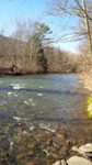
OMG did the hurricanes and storms change the stream! The creek is much wider and only a foot deep where it was four feet deep before!!
The big "tree" at the Hemlocks is gone now! Tons of gravel filled most of the creek and it's only half the depth it was last year. When you walk in, the deep pools are now filled with gravel!..... still better than mud, but WTF is going on? Even on the high banks, there is tons of sand where grass was before? It must have been a super flood?
I guess it was stocked today. I saw footprints where they would walk in and out?
I saw one fish, maybe a small trout or maybe a sucker, but didn't get a hit with my streamers. A kid below the wire said he caught a small chub with worms on a spin rod, but that was it!!
Now, Maurice, don't get upset with me!! I know that you love this stream....... so do I! All I can say is: That creek is changing every year and not changing for the good!! Five years ago it was a fly fishing paradise..... now ???
 
Um yes it was a super flood, 99% of all streams are now changed. There is sections of Clarks creek that have beaches on it now
 
When the farm lands and the materials from eroded creek banks end up in the creeks of the "Susquehanna hill country" of York and Lancaster Counties, this is what you get. The silt gets blown out, but the sand and flat gravel, usually composed of Wissahickon schist and shale or siltstone, remains. Additionally, the material from unconsolidated creek bottoms and gravel bars (from previous storm events) moves and contributes to the filling of pools as well, often producing long, flat, shallow pools under more typical low to moderate flow conditions that eventually follow. In some stretches the negative changes are permanent; in others they are temporary. Unfortunately, the permanent changes seem to outnumber the temporary ones in these situations. Sometimes, however, new, good habitat is created in some isolated spots.
 
Mike wrote:
When the farm lands and the materials from eroded creek banks end up in the creeks of the "Susquehanna hill country" of York and Lancaster Counties, this is what you get. The silt gets blown out, but the sand and flat gravel, usually composed of Wissahickon schist and shale or siltstone, remains. Additionally, the material from unconsolidated creek bottoms and gravel bars (from previous storm events) moves and contributes to the filling of pools as well, often producing long, flat, shallow pools under more typical low to moderate flow conditions that eventually follow. In some stretches the negative changes are permanent; in others they are temporary. Unfortunately, the permanent changes seem to outnumber the temporary ones in these situations. Sometimes, however, new, good habitat is created in some isolated spots.

Thanks for the info, Mike. I had to look up "Wissahickon schist." The Wissy appears to be famous for something other than chubs, sunnies and stocked trout:

Geology

A tremendous variety of geology is evident along Wissahickon Creek. Three of the geologic regions that the stream passes through are the Newark Basin of Triassic sandstone and shale, the limestone and dolomite of the Chester Valley, and the Wissahickon Formation where the waters of the stream flow into the Schuylkill and eventually the Delaware Rivers.

A unique and very distinctive rock of the Wissahickon Creek valley is Wissahickon schist, the predominant bedrock underlying the Philadelphia region, found over a broad swath of southeastern Pennsylvania from Trenton into Delaware and Maryland. This Precambrian to Cambrian stone, first studied in the Wissahickon gorge, has flecks of glittery mica, small garnets, and many-toned shadings of gray, brown, tan, and blue, and is attractive enough to have become a common building material in the 19th and early 20th centuries.

In addition to Wissahickon schist, there are layers of quartzite in the valley. Both schist and quartzite are metamorphic rocks formed from sedimentary deposits of mud and sand that one time were washed from ancient continents into a shallow sea. These sedimentary deposits were over time compressed into shale and sandstone. During long periods of mountain building, the shale and sandstone were slowly transformed into the schist and quartzite found today. In some places, the compression and heat were extreme enough to fuse the schist with emerging igneous rocks into hard-banded gneiss.

Other rocks in the valley are layers of igneous pegmatite and remains of granite plutons, embedded crystals within the schist. A few locations close to Devil’s Pool and along Bell’s Mill Road have a talc schist which contains the mineral talc, so soft it can be scratched with a fingernail.


Link to source: http://en.wikipedia.org/wiki/Wissahickon_Creek
 
So the cause of the recent widening of Muddy Creek is farmland? That area has been farmed for about 300 years. You'd think that farming induced widening would have reach it's max long ago.

My guess is that the more recent widening is due to urbanization, i.e. more impervious surfaces (pavement and roofs) causing higher stormwater runoff peaks, which enlarges stream channels.

Also, if people are mowing the stream banks, rather than leaving them forested, the bank will rapidly get eroded back. There are sections of Spring Creek that are well vegetated that show little signs of erosion. But another section is mowed close and that bank has retreated about 8 feet over the years.
 
troutbert wrote:
So the cause of the recent widening of Muddy Creek is farmland?

That's not what he's saying. Silt from nearby farm lands and other sources builds up in the stream bed over time and then it get's blown out in a high water event like we just had. In some areas as the water recedes, deposits of silt are left behind to fill in holes. I think in the case of Muddy Creek it comes down to major flooding just tearing up banks in some areas thus widening the stream. Saw the same thing in place on the Quitty last weekend. The sections of Muddy Creek I'm familiar with would be very prone to being damaged in the kind of high water we had due to lack of bank stabilization in spots. Every time I fish there something is different due to a past high water event.
 
Mike wrote:
When the farm lands and the materials from eroded creek banks end up in the creeks of the "Susquehanna hill country" of York and Lancaster Counties, this is what you get. The silt gets blown out, but the sand and flat gravel, usually composed of Wissahickon schist and shale or siltstone, remains. Additionally, the material from unconsolidated creek bottoms and gravel bars (from previous storm events) moves and contributes to the filling of pools as well, often producing long, flat, shallow pools under more typical low to moderate flow conditions that eventually follow. In some stretches the negative changes are permanent; in others they are temporary. Unfortunately, the permanent changes seem to outnumber the temporary ones in these situations. Sometimes, however, new, good habitat is created in some isolated spots.

I think there may be an element of stream size and the outcomes of the permanent effects of a 100-year flood. Two first and second water streams that I fished last week are in the best shape I've seen them. Silt is gone and the fish can actually get in under the larger pieces of schist, where they couldn't before. Both streams may have slightly higher gradients than Muddy. I have one more smaller stream to test this hypothesis on; geology is the same for all the streams, but its slightly bigger (third or fourth order) than my other two streams.
 
Relax y'all.....Muddy Creek is a large watershed. Its hardly destroyed. The storms last month put it on the road twice. One of those times higher than it was in '72 during Agnes. The OP visited an area that comprises 1/15th of the streams total length after the confluence of the North and South branches. The other 14/15 is a deep forested gorge typically stable by huge rock outcrops and bedrock. The reach from the lower fly area to the Woodbine bridge is a mile long and the ONLY reach paralleled b a road.

So here is the deal, You have a very large watershed mostly stable in a forested gorge of moderate gradient that has reaches of flat, inhabitated and easily accessible for anglers. When the watershed receives copious amounts of rainfall the high velocity flows flush/scour bedload (typically the wissy schist and silt) from the higher gradient areas to settle in the lower gradient areas. I call these exhale reaches.

These areas are wide flat and as shallow as the next gradient change allows them to be. Pool depth is determined by downstream grade change at the tailout created by either bedrock or riffle (bedload deposits over natural bedrock grade control) Thawig pool depth never changes, Its bedrock, what changes is the distribution of the bedload. Some pools are filled and some scoured with extreme weather events. Its the exception, with moderate rainfall events bedload will flush from pools and rebuild riffles.

The OPs observations of widening are not occurring to my knowedge. The stream has reached its widest point years ago. The distribution of this sediment is a streams way of fixing itself. The shallow areas he points out area actually point bars and gravel bars adjacent to the thawig (deepest channel area of the stream). It can leave one awestruck to see how these areas live and breath. But make no mistake, The stream is by far deeper in far more areas of the thawig than it has been made shallower.

I know one area upstream of the hemlocks where the point bar that has been there since I can remember has been eliminated. Thats amazing. But thats how stream dynamics work, Pointbars erode and build, pools fill and scour. Surprisingly, the pool next to it is deeper overall, the Hemlocks received much of the bedload in this reach. After the next heavy rain it will reform its normal self.

Its much ado about nothing.....And it was NEVER a flyfishing paradise. Its a stocked trout stream with thermal issues that happens to hold a good deal of wild fish most of the year. So I thinks shes doing better now than when it was a "paradise". (over the last 12 years).
 
[color=0000FF]I know one area upstream of the hemlocks where the point bar that has been there since I can remember has been eliminated. Thats amazing.[/color]

Yes it is!! That is where folks walk in when they park in the lower parking lot. Last year it had a tree there and was 4' deep, now it's 1' deep. Also on the top of the bank it is covered with sand now?
Hey, Maurice, who is the OP? and what does that mean? I'm a friend that fishes all the Muddy Creeks and catches a lot of trout. I'm just being honest about the changes that are happening in our local streams.
And it was a "paradise" only a few years ago. Same thing with the Muddy Creek Forks, it was truly a trout paradise. Now it's posted and privatized with bulldozed paths all over and warning signs to tell the fishermen to stay in the creek and don't step on the private property! The train only goes back a little and I have been chased off the tracks and told "this is now private property, get out" A lot further downstream a guy came down the hill with a shotgun in his hand and told me to get off his private creek?? State stocked, but he thought he owned it!!
Maurice, I know that you are involved with TU and I was going to help with the stocking next year. Please don't think I'm badmouthing the stream just because I mention all the major changes I see.

I meant no disrespect when I mentioned how shallow the creek is getting.
 
1wt wrote:

Hey, Maurice, who is the OP? and what does that mean?

"OP," in the context of a web forum, means "original poster" and simply refers to the initial person who started the thread.
 
1wt wrote:
[color=0000FF]I know one area upstream of the hemlocks where the point bar that has been there since I can remember has been eliminated. Thats amazing.[/color]

Yes it is!! That is where folks walk in when they park in the lower parking lot. Last year it had a tree there and was 4' deep, now it's 1' deep.

It was NEVER 4 ft deep there. Its now over your knees and wider granted but that just presents a different fishing challenge. The depth of the run on the near bank has become deeper even though its wider. Because of the run above that flushed out the old bedload. Thats all now in the hemlocks as I said.

Also on the top of the bank it is covered with sand now?
Hey, Maurice, who is the OP? and what does that mean? I'm a friend that fishes all the Muddy Creeks and catches a lot of trout. I'm just being honest about the changes that are happening in our local streams.

OP is you in this case "original poster". There are changes, some big ones. but you are mistaken to assess the overall changes to be negative. In this case the changes have exposed more holding areas than the covered. The sand on the high banks is just the distribution of "fines" in the least velocity areas. In this case some ten ft above the stream level on the flood plain. Keep in mind the water was 4ft deep where that sand is during the flood.
And it was a "paradise" only a few years ago. Same thing with the Muddy Creek Forks, it was truly a trout paradise. Now it's posted and privatized with bulldozed paths all over and warning signs to tell the fishermen to stay in the creek and don't step on the private property! The train only goes back a little and I have been chased off the tracks and told "this is now private property, get out" A lot further downstream a guy came down the hill with a shotgun in his hand and told me to get off his private creek?? State stocked, but he thought he owned it!!

The stretch below the forks you speak of was a point of contention prior to the opening of the season. The Railroad society has a right away for the entire corridor theoretically but the land is owned on both sides b private landowners. The particular landowner below the forks was bullying the railroad early this year and that area was almost not stocked. Through the cooperation of MCTU and our WCO Kephart an agreement was reached when WCO kephart visited the landowner and he was pleased to allow fishing so long as the anglers stayed along the stream and not wandered up along the tracks. You seem to have disobeyed the signs jeopardizing the hard work of others. Next time follow the instructions and stay in the crik.

In addition the reach below this (Zimmerman) has been posted for the most part and OFF the stocking list for more than 20 years. In the 80's the Zimmerman access was as popular as the forks....too popular which is why it became posted. Its remote and a hotspot for partiers. I've never been chased from there though.Although I don't fish it often. But that is nearly a mile below the forks.

Maurice, I know that you are involved with TU and I was going to help with the stocking next year. Please don't think I'm badmouthing the stream just because I mention all the major changes I see.

I meant no disrespect when I mentioned how shallow the creek is getting.
Again its not getting shallower. Your characterization is inaccurate and damaging to how it is and could be managed. Seems our AFM sees little value in the area and hasn't visited or seen the stream in nearly a decade. Your characterizations cause unjustified concerns for him and cries of wolf can only cause harm to the eventual management of a perfectly suitable C&R FFO area.

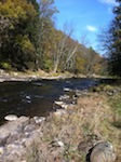
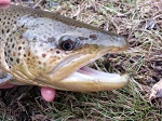
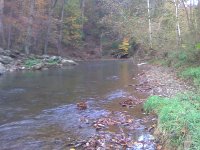
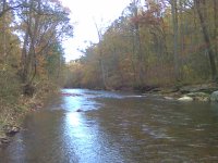
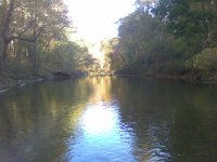
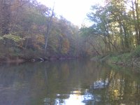
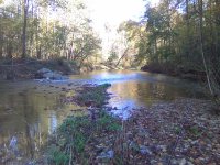
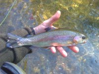
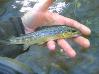
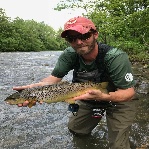
I will include some photos I took today while only catching 2 trout, I am sure I fished over many more. IN the upper FFO area and the gradient change the water is so deep in so many areas its difficult to assess where the best lies are. Plus leaves were a ***** today.

Anway, stay away from the hemlocks till the next big storm. And oh yeah.....when you find a gravel bar where you feel the crik is too shallow, stand on it and fish to the far bank...because where the water isn't shallow its DEEP!. So if yer in shallow deep is nearby. And by deep I mean 1.5 -3' deep (knee to waist deep) Thats where the fish hold. Its the most common water and the mean depth of the thawig throughout the stream. There are much deeper areas but you cannot expect to have that depth everywhere, its not a lake.

I saw some changes upstream as well but for the most part the water is deeper because of where and to the extreme bedload was deposited, some places the thawig was inverted to the opposite bank, mid channel bars were nearly gone, but its all better now. The fly area always had a few flat wide stretched where the fines settle. If you've fished it for years you'd know where they are.

 

Attachments

  • 10162011_002.jpg
    10162011_002.jpg
    271.4 KB · Views: 16
  • 10162011_005.jpg
    10162011_005.jpg
    256.3 KB · Views: 12
  • 10162011_016.jpg
    10162011_016.jpg
    237.3 KB · Views: 13
  • 10162011_017.jpg
    10162011_017.jpg
    242.1 KB · Views: 11
  • 10162011_019.jpg
    10162011_019.jpg
    317.9 KB · Views: 17
  • 10162011_024.jpg
    10162011_024.jpg
    223.7 KB · Views: 10
  • 10162011_025.jpg
    10162011_025.jpg
    194.9 KB · Views: 14
Maurice: The OP was not of great concern to the AFM. Start talking about posting and you'll get his attention. By the way, the AFM has seen the stream a few times in the past decade and has kept up on any posting concerns through conversations with the WCO. In fact, the AFM was glad to learn of no concerns at one former site of contention.
 
[color=0000FF]Anway, stay away from the hemlocks till the next big storm. And oh yeah.....when you find a gravel bar where you feel the crik is too shallow, stand on it and fish to the far bank...because where the water isn't shallow its DEEP![/color]

Thanks for the tip!!
Nice couple of trout, Maurice! Way to go! What did you catch them on? How come no report with pix?
 
I fished from the upper wire down to the Big Rock hole (2/3 of the project) and I fished it hard. Buggers of all colors, wetflies in green and orange and with partridge. IPWs, for four hours in the morning before the sun was on the water. Leaves got bad around 10:00am. Caught my first fish trying to get from being hung up on the bottom, dangling the dropper orange wet. An accident really. The second wild one came on a shallow side channel near some deep water on a white bugger.

The fish were not on Sunday am. But I had a beautiful day checking out the changes to the crik. Half the time while fishing downstream I had trouble finding the new runs. Sometimes they shifted a few feet sometimes they shifted across the creek because of blow downs. So I probably pushed fish all over the creek.

The lower project got the brunt of the gravel load. The upper is flushed pretty good.

 
[color=0000FF]The lower project got the brunt of the gravel load. The upper is flushed pretty good. [/color]

Maurice,
Thanks so much, TU dude! Next time I'll park at the upstream section and walk down the trail and fish the remote water. That's where I usually go..... I'm not too lazy to walk down that beautiful nature trail!! LOL
Sorry if my remarks got you upset! I was a little "shocked" when I saw the changes, but I must say that you have done a wonderful job with TU and that wonderful creek.
So please, everybody, don't think that I'm knocking our local trout streams! I love to fly fish just as much as you do...... maybe more!!
 
Maurice: How did the Mann weir field make out during the flood? Any dramatic changes there?
 
I Don't know....hadn't checked it out yet. But the high flows go over the point bar and make a mess of the area.....I am sure it did this time too. But the structures should be fine. They've stood up to that flow three times since they were installed not counting this one.

Four 100 year flood events in 8 years....someone needs to change their model.
 
You know, I have to laugh and shake my head at the same time. As some people on here know, I haven't been on the site much in the past year, and I know I'm giving this old thread a bump, but .... I just have to comment. It occurs to me that every single time the "OP" posts about Muddy Creek, it is negative. It also occurs to me that the OP seems to fish the same tired a** hole or two situated within a stones throw from a parking area. Unlike the OP however, I have traversed many miles of the stream itself and its tributaries in search of it's ever migrating wild brown trout population. The area in question, which happens to be the extreme lower fly stretch, is probably the slowest, widest, shallowest, least productive and not to mention most overfished 1 percent of the entire watershed. It's a long flat with a few holding spots.
 
You aren't really suggesting that habitat has anything to do with the longer term quality of the fishing experience for stocked trout are you? (said with tongue in cheek).
 
Now, that said, not only does the hemlocks area represent a miniscule fraction of the watershed, it also only represents a small fraction of the CARFFO area, of which Im certain the OP has not even explored beyond his usual spots down at the extreme lower fly stretch. Most other areas of main branch I fish are fast deep and difficult to wade in places with many deep ( over your head ) holes, and the banks and streambed are lined car sized boulders. Just look through my profile at the pics I have posted on the site. I can't post them on this thread due to using my phone currently.
 
Back
Top