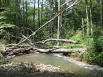
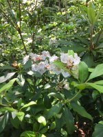
Forgot that conservation folks provide great ground-level images of the tiny nepa stream I mentioned post 7 that is lined w hemlock ... see images from about #750-770 in the large file below:
chrome-extension://efaidnbmnnnibpcajpcglclefindmkaj/https://www.epcamr.org/storage/watersheds/SolomonCreekCHPPhotoEssayCombined(web).pdf
this unusually well hemlock-lined trib is approx 41.199352, -75.871296 ... doesn't fish very well due to high acidity.
still it's a good cherry-picked tree example 🙂 of how hemlocks sometimes line small PA tribs and can be good to fly fish under. the hemlocks provide some shade also.
here, the surrounding trees are not rhodo and they do lose their leaves. so these on-stream hemlocks will really stand out on any leaf-off satellite map.
but when some hemlock trees are on a stream in a rhodo expanse, they can be tough to see in leaf-off map.... hemlock color could be similar to rhodo color & rhodo doesn't lose its leaves. however, the height of any on-stream hemlocks and the surrounding rhodo may differ sharply. hemlocks can throw shade, which may sometimes be suggested in a good leaf off map.
for ex., as in my OP here, if you put "oberson run" as location in the tree-height map, it's a total carbon county rhodo-hell area. to me, the only real suggestion of taller trees on oberson using "lighter suggests taller" idea w tree-height map is on oberson just above quakake. if you zoom the tree-heights map's satellite image to the very spot with some lighter areas, toggle layers, imho there's evidence of some taller trees (looks like shade from some taller trees in the satellite image). YMMV. as noted in thread, taller trees in a large rhodo expanse may well be hemlocks, and hemlocks are sometimes located near streams.
so maybe two maps are better than one. in some rhodo-expanse hell places I am familiar with, the tree-height map may be doing a better job of flagging some on-stream hemlock trees than a leaf off one,,, again just imho.
kinda nice a free world wide map! but I think this use is very limited to only the most serious rhodo-hell areas. 'course we have them carbon county, some schuylkill, etc...
btw, I think it is good to wary of AI hype, but the accompanying video to tree height map suggests some added precision vs other maps, so it could help a bit.
(large photo file linked here done by outstanding folks @ eastern pa coalition for abandoned mine land recovery, wilkes barre) (trib in images = liming candidate?)