Penns Creek, Mifflin County, 4/26/23

IrishFan

Member
Joined
Jan 13, 2023
Messages
44
City
Jefferson, PA
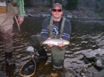
First time on Penns yesterday. Walked from the gate a Cherry Run. I walked a long way, seemed even longer walking out. A gentleman told me I was actually closer to the tunnel at Poe Paddy.

Long story short, lots of fish rising. Missed or hooked 6 or 7. Never landed one. March Browns and tan Caddis all over. Fished from around 11:30 to 3:45 then had to leave for a conference.

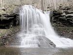
Beautiful area. One of the best I’ve been to. Can’t wait to head back.

Is primitive camping allowed in the section I fished? Any info is greatly appreciated.
 
Last edited by a moderator:

Sounds like a lot of fun. FWIW, camping isn't allowed near the stream - PFBC has an easement or something along the stream so the rules are different than the State Forest rules within a certain distance of the water. That said, there are fire rings here and there and some really sweet campsites that I may or may not visit several times a year.

Beware - every time camping on Penns comes up on the forum it turns into a debate about just what the rules are and whether or not they should be obeyed....
 
I don't know the boundaries between the state forest and fish commission land. However, there are several designated camping sites up on the mountain. Also, the Union County Sportsman's Club has primitive sites directly on Penns Creek.
 
Especially the ones on Old Mingle Road. It would be a long walk but the access to Penns at the end of Old Mingle is perfect.
 
Can you park somewhere at the end of Old Mingle road to fish?
yes and no. The state put up a gate a couple of years ago, blocking access to the former parking area that was at end of the road. My guess would be a mile walk from the gate to the creek.
 
Sounds like a lot of fun. FWIW, camping isn't allowed near the stream - PFBC has an easement or something along the stream so the rules are different than the State Forest rules within a certain distance of the water. That said, there are fire rings here and there and some really sweet campsites that I may or may not visit several times a year.

Beware - every time camping on Penns comes up on the forum it turns into a debate about just what the rules are and whether or not they should be obeyed....
The PFBC owns some land there. Camping on PFBC land is prohibited.

DCNR Bureau of Forestry owns land there. State forest land has different rules about camping.
 
Was there Weds-Thursday , yes MB’s and tan Caddis. More Caddis Thursday.

Also whatever you experienced wading- don’t get used to that, it’s usually several inches higher and thus limiting wading options. But no doubt beautiful.
 
Not going to enter debate on primitive camping.

But Poe Paddy SP is reasonably priced, very tent friendly, primitive for a state park campground, easy to reserve, fairly cheap, and streamside in the heart of Penn's best water.
 
Is there a map of PFBC land owned (or leased, etc.) in PA?

Exactly who owns what parts of the property all along Penns, for example from Poe Paddy to Cherry Run?

Kind of as an aside, I remember (or at least I think I remember) being involved in a discussion sometime probably back in the 1970’s about a lot of that land along Penns Creek being for sale. I kind of remember that someone said it was owned by a woman who was selling it for something like $100-$200/acre.

We used to camp a lot at Poe Paddy back then, and we “regulars” had lots of discussions around the campfire at night, with a few beers, so I wouldn’t swear that my memory from that long back is 100% accurate today - maybe just 99% accurate. 😊

John
 
TKudYf3.png
 
Inside the green is PFBC. They own all the banks from the tunnel down to near Cherry Run.

The rest is SF, which gets close to the south bank for stretches.
 
Inside the green is PFBC. They own all the banks from the tunnel down to near Cherry Run.

The rest is SF, which gets close to the south bank for stretches.
Can you give me the link to the website, or where this map is found? Thanks.
 
That's from OnX. They compile local ArcGIS data into statewide/nationwide maps. It is a paid app but they usually have a free trial available.

You can source most of it independently but OnX makes it more easily accessible. I haven't looked at Union or Centre County data but I know Mifflin Co's is available online for free.
 
Back
Top