Mud Run - Carbon County - 7-16-19

Out4Trout

Member
Joined
Nov 29, 2017
Messages
182
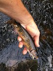
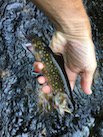
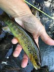
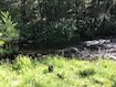
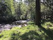
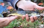
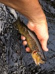
With the higher temps lately, I have been focused more on our smaller mountains streams up here in the Poconos. Mud Run is fishing very well right now. Green Weenies and Black Wooly Buggers seem to work in the mornings and any caddis with get em topside in the late afternoon early evening. I still cant wet wade because the water is quite cold.

Tight Lines !!


Attachments

  • Mud Run 1.jpg
    Mud Run 1.jpg
    14.6 KB · Views: 10
  • Mud Run 2.jpg
    Mud Run 2.jpg
    14.5 KB · Views: 12
  • Mud Run 3.jpg
    Mud Run 3.jpg
    14.8 KB · Views: 6
  • Mud Run 4.jpg
    Mud Run 4.jpg
    15.2 KB · Views: 4
  • Mud Run 5.jpg
    Mud Run 5.jpg
    10.1 KB · Views: 15
  • Mud Run 6.jpg
    Mud Run 6.jpg
    10.2 KB · Views: 14
I moved to White Haven three years ago and still have not fished Mud Run. I would like to give it a shot but from what I can tell the best way down to it is to take Hawk Falls trail . I have not tried this trail yet because I heard that it is steep and I have some medical issues with my one foot where steep hills give me an issue. I can do it but it will take me longer than most. I was just wondering if there was a better way to get to Mud Run or should I just suck it up and take the Hawk falls trail.
 
REDNECK_FLYFISHER wrote:
I moved to White Haven three years ago and still have not fished Mud Run. I would like to give it a shot but from what I can tell the best way down to it is to take Hawk Falls trail . I have not tried this trail yet because I heard that it is steep and I have some medical issues with my one foot where steep hills give me an issue. I can do it but it will take me longer than most. I was just wondering if there was a better way to get to Mud Run or should I just suck it up and take the Hawk falls trail.

Traveling on 534 east towards Albrightsville, pass the Hawk Falls parking area to the next road on the right (the last road in the Park) which I believe is the organized camping area. Drive down that road past all the campsites to the last parking lot at the end of the road (the road ends with a gate). You can walk in past the gate on the dirt road which will lead you down to Mud Run. It's downhill, but not too steep. You are able to fish either up or downstream from there.

Map is included here > https://www.mobilemaplets.com/showplace/903

Good luck fishing.
 
Google maps shows what I guess is service road for maybe power lines off 903 that,s a straight shot to Mud Creek. There looks like a little pull off spot to park off 903 to. I'm not sure if its shorter, easier, or possible because I have never been there. Again I'm going off google maps.

I'm actually thinking about heading/ hiking up there this weekend. Someone suggested it and it looks beautiful.
 
My question is how do you access the portion of Mud Run that's downstream from the mouth of Hawk Run? I went down the Hawk Run trail to the waterfall a few weeks ago and was looking to fish downstream from there but I couldn't find any trails. And wading downstream wasn't an option bc it's a small gorge thru there and the water was deep right up to the the bank. Or is it better to just fish upstream from Hawk Run?? Thanks.
 
Are you talking about the delayed harvest area? If so it is a long walk down to the stream and even longer to walk back up after fishing. I know because I have been down there with the stocking truck a few times. Great fishing but long walk so be prepared and hydrate.
 
Clams wrote:
My question is how do you access the portion of Mud Run that's downstream from the mouth of Hawk Run? I went down the Hawk Run trail to the waterfall a few weeks ago and was looking to fish downstream from there but I couldn't find any trails. And wading downstream wasn't an option bc it's a small gorge thru there and the water was deep right up to the the bank. Or is it better to just fish upstream from Hawk Run?? Thanks.

This is something we've tried to figure out on here before, and I'm not sure we've really solved it yet. Supposedly, there is (or used to be) a trail leading down to the stream from the open field/dirt lot off of 534, just to the west of the TPike. (A couple hundred yards west along 534 from the Hawk Falls lot.)

^I've parked there and tried this. I found what I thought were a couple trails but they all petered out into a fortress type wall of rhododendron. After an hour or 90 minutes or so, I gave up, and just fished Hawk, and Mud upstream from Hawk that day. There's no way to climb through all that rhodo, and there's no way as you note to walk the stream down from the bottom of the Hawk Falls trail...There's a massive pool with sheer rock on both sides that you can't wade through just a short bit below the confluence with Hawk. You can't access from below because of posting on the Graystone property.

Getting down from that dirt lot/open field seems the only possible option, but I haven't figured it out. If someone finds that trail, or blazes a new one, let me know. Otherwise I'm not sure I'm going to try to battle that rhodo again. It'd be a fun fish up from the lower SP boundary to the mouth of Hawk I think.

 
Swattie87 wrote:
Clams wrote:
My question is how do you access the portion of Mud Run that's downstream from the mouth of Hawk Run? I went down the Hawk Run trail to the waterfall a few weeks ago and was looking to fish downstream from there but I couldn't find any trails. And wading downstream wasn't an option bc it's a small gorge thru there and the water was deep right up to the the bank. Or is it better to just fish upstream from Hawk Run?? Thanks.

This is something we've tried to figure out on here before, and I'm not sure we've really solved it yet. Supposedly, there is (or used to be) a trail leading down to the stream from the open field/dirt lot off of 534, just to the west of the TPike. (A couple hundred yards west along 534 from the Hawk Falls lot.)

^I've parked there and tried this. I found what I thought were a couple trails but they all petered out into a fortress type wall of rhododendron. After an hour or 90 minutes or so, I gave up, and just fished Hawk, and Mud upstream from Hawk that day. There's no way to climb through all that rhodo, and there's no way as you note to walk the stream down from the bottom of the Hawk Falls trail...There's a massive pool with sheer rock on both sides that you can't wade through just a short bit below the confluence with Hawk. You can't access from below because of posting on the Graystone property.

Getting down from that dirt lot/open field seems the only possible option, but I haven't figured it out. If someone finds that trail, or blazes a new one, let me know. Otherwise I'm not sure I'm going to try to battle that rhodo again. It'd be a fun fish up from the lower SP boundary to the mouth of Hawk I think.


Here is a thread discussing hiking info for this area > Mud Run

There was a faint trail along the HRSP border that could be followed down to the border of the Greystone property. If that is grown in, you're really on your own with a compass.

The area is a greater hike than a fishing spot, but if you ever wish to try it, be careful.
 
Swattie,

I started fishing Mud Run in the early 70's, and we did park in that field off 534. At that time the trail was wide and well defined. And it was an easy hike down to the creek. It was the only stretch I used to fish. Haven't been there for years.
 
Back
Top