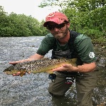
Spent part of the morning and early afternoon up in the FFO section. I hiked/fished from the Bonneybrook Bridge down to I81.
WEATHER: Very nice; high 60s-70s, partly sunny.
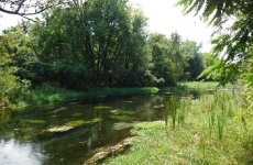
WATER: Crystal clear, strong flow, 54 degrees F (confirmed by thermometer).
INSECTS/HATCHES: None. No rises seen.
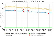
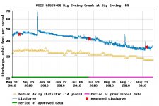
All things considered, Letort, like other CV streams, looks very good these days. The flows are stronger than I can remember and many areas that used to be sediment laden are now gravel bottom. The stream looks good. Some of the work by CVTU in the upper area is promising. Bankside vegetation is lower than it was earlier in the summer the last time I was there, but still extremely dense. Many meadows that I could easily fish back in the 1980s are now essentially inaccessible due to high water up in the canary grass and swampy muck, too deep to walk through. It will probably be a cold winter day before I get back into some of my favorite spots. Physically, the stream is just really tough. This is typical in summer, but the water levels in the meadows make it worse than usual these days.
I caught one fish on a scud. As you know, Letort is notorious for shutting down on sunny days and I saw few fish (did spook a large one) but some were visible in typical spots and likely catchable if one could get into position to cast.
WEATHER: Very nice; high 60s-70s, partly sunny.
WATER: Crystal clear, strong flow, 54 degrees F (confirmed by thermometer).
INSECTS/HATCHES: None. No rises seen.
All things considered, Letort, like other CV streams, looks very good these days. The flows are stronger than I can remember and many areas that used to be sediment laden are now gravel bottom. The stream looks good. Some of the work by CVTU in the upper area is promising. Bankside vegetation is lower than it was earlier in the summer the last time I was there, but still extremely dense. Many meadows that I could easily fish back in the 1980s are now essentially inaccessible due to high water up in the canary grass and swampy muck, too deep to walk through. It will probably be a cold winter day before I get back into some of my favorite spots. Physically, the stream is just really tough. This is typical in summer, but the water levels in the meadows make it worse than usual these days.
I caught one fish on a scud. As you know, Letort is notorious for shutting down on sunny days and I saw few fish (did spook a large one) but some were visible in typical spots and likely catchable if one could get into position to cast.