JoeB27
New member
- Joined
- May 7, 2011
- Messages
- 12
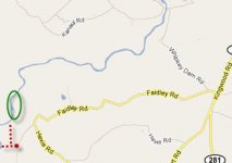
Fished Laurel Hill Creek a couple of miles or so downstream from the Whipkey Dam area from 8:30am until around 1pm. Water was on the high side and off color but still had a pretty good day.
My brother-in-law pick up about twenty mostly rainbows with one small mouth thrown in. Most were picked up on size 14 & 12 beadhead pheasant tails. His first catch of the day was a nice size golden trout. Later he topped that with a hefty maybe twenty-inch rainbow.
I picked up a few small rainbows on a pheasant tail and missed a few others. Added a cream color, beadhead caddis on a droper and picked up a couple of on that. When thing slowed down I changed to the L.L. Bean Thin Mint streamer and immediately picked up five nice size raindows and one small, small mouth.
Most of our fish were caught in the deeper pools but I did pick up a few in the smaller pocket water.
All in all a great day on a beautiful stretch of stream with not another person in sight.
My brother-in-law pick up about twenty mostly rainbows with one small mouth thrown in. Most were picked up on size 14 & 12 beadhead pheasant tails. His first catch of the day was a nice size golden trout. Later he topped that with a hefty maybe twenty-inch rainbow.
I picked up a few small rainbows on a pheasant tail and missed a few others. Added a cream color, beadhead caddis on a droper and picked up a couple of on that. When thing slowed down I changed to the L.L. Bean Thin Mint streamer and immediately picked up five nice size raindows and one small, small mouth.
Most of our fish were caught in the deeper pools but I did pick up a few in the smaller pocket water.
All in all a great day on a beautiful stretch of stream with not another person in sight.