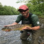
Hammer Creek, Lancaster/Lebanon Cos., 9/23-27/13

I am clearly not an internet person like you haha. I apologize, this is the first time I've been online since. A friend of mine who works for TCO just recently told me of the site "not a regular." And I did not fish the posted land you are talking about. If you re-read what I said was the water LOOKS great there. I usually work up from the main lot to the point halfway between the posted land you're referring to where the power lines run. And my intention was not to boast! Just to inform!
dc410 wrote:
He probably has a flashback to one of those "messin' with Sasquatch" commercials. :-D
 
SmellyTroutHole,

The post that you quoted me on was intended to be a joke in response to the fellow that Sasquatch referred to bumping into when he fished the Obie road area (post #8). It was not aimed at you. I apologize if you had interpreted it that way. That can the problem with Internet message boards ..... Sometimes a post can easily be interpreted by someone on the other end as something totally not what the poster intended. Its hard to put inflection into words. Tight lines.

dc410
 
Just an FYI for everyone but the land directly below the 322 bridge is owned by Lancaster County Conservancy and fishing is not permitted. This is not marked well but last I knew it was off limits to fishing. It is a shame because this section holds a lot of nice holdover fish. I fished it about 10 years ago and then found the no fishing signs.
 
The only signs are "no hunting" signs now. I've heard this before about the conservancy, and actively looked for "no fishing" signs. It appears to be open for fishing now, and has been for at least 2 years.
 
It would be nice if someone could clarify the posted sections below the 322 bridge. I was in the conservancy hiking around during the summer and there is some really nice water in this area. I only saw one really old posted sign and what looked to an old broken down fence that once stretched across the stream. There was a pretty well beaten path along the bank but I suppose that could be from hikers. Does anyone know if the whole stretch is open? Btw the bridge below the conservancy is clearly posted by a sportsman club.
 
The bridge below the conservancy? You mean at Speedwell Forge Rd? It's been a while since I've been down there, but the entire stretch from SFR to 322 is open to my knowledge. I've never seen a sign stating otherwise and last year I fished that stretch quite a bit. If it was closed in the past, it's been open.
 
The speedwell forge bridge at the conservancy has a lot of posted signs on it saying fishing for members only but the opposite side going upstream towards 322 doesn't have any signs. As you walk up stream there are a lot of old signs saying something similar but I can't quite remember.
 
Mike wrote:
The recent sampling sites have been run at various locations from about where you can see the old deflectors from the dirt road upstream to the area behind the houses, all within the stocked trout section. Yes, there have been browns in the catches........from memory, perhaps a dozen in 300 m. of electrofishing.
Mike behind those houses, I think you told me before that since its w/in the stocking area, the owners are cool w/ people fishing through there? I bring it up because the one house has a new owner. KeithS and I actually met him when we were fishing through the one day. Nice guy, cool w/ us fishing up through his property. If the land owners would decide they didn't want people fishing through their property, would that effect how high up you stock fish?
 
The_Sasquatch wrote:
After threatening me, he told me that although the land owners don't post the land at Odie road, they may not want me fishing there. I told him I spoke w/ two women earlier and they were fine w/ it. He kind of grimaced. I had an okay exchange w/ him after that. I think he saw I wasn't some slob out there leaving bait containers and beer cans all over the place...but I never did have the guts to ask if I could fish on his land.
Maybe it really wasn't the landowners, maybe it was just him, and that is harrassment and he is breaking the law.
I fished it once with good flows and didn't see or catch a trout.
 
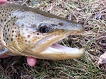
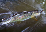
I fished Hammer on Saturday. Got the "Trifecta" except the bow was obviously stocked. Flows were great, time to lay off. The brookies are definitely getting ready to spawn. The oranges I saw were outstanding. The size of the brookies never ceases to amaze me.
 
Has anyone ever contacted the Boy Scouts to see if they can get permission to fish that stretch?
 
I just checked the website for the Lancaster County Conservancy and it still says that fishing is prohibited at the Upper Hopewell Preserve, which is the water between 322 and the upper bridge along Speedwell forge road. This has never been well marked along the preserve, but fishing is not permitted per the conservancy rules.
 
I really don't think it's EVER been enforced. That area is pounded by baiters and spinning guys in the early season. I confess I fish it almost year 'round, though I haven't fished that stretch as much this past year.

It is clearly marked as "No Hunting". If the conservancy doens't want fishing between those bridges, they need to mark it streamside and mark it clearly. I have heard this before about the stretch, and have searched diligently for signage, at least on the Pumping Station Rd side. There is nothing. Again, only "No Hunting" signs.
 
The_Sasquatch wrote:
I really don't think it's EVER been enforced. That area is pounded by baiters and spinning guys in the early season. I confess I fish it almost year 'round, though I haven't fished that stretch as much this past year.

It is clearly marked as "No Hunting". If the conservancy doens't want fishing between those bridges, they need to mark it streamside and mark it clearly. I have heard this before about the stretch, and have searched diligently for signage, at least on the Pumping Station Rd side. There is nothing. Again, only "No Hunting" signs.

I did the same thing the first and only time I fished it; fished right up through oblivious to the no fishing rule. I saw the note on the Conservancy website a bit later. Posted or not, if you know a landowner prohibits fishing, do you still continue to fish it?
 
i'd like to fish this creek - whats a good proxy stream to use as a guide to water levels ? - the swattie ?
 
You know, I'm tired of this debate. I'm going to email the conservancy. I don't give a crap what their website says, to be honest with you. If they don't want fishing, they have to post it. PA is a right to use state, which means if they don't want people in the stream on their land, they have to make it known. Posting a sentence on their website is hardly making it known. Kind of like "Hitchhiker's Guide" where they say it was clearly posted that Earth was scheduled for destruction. I'm not convinced they don't want to allow fishing. Otherwise, why would they post it for hunting but not fishing?

I'll let you guys know what I find out from the conservancy. I'm not mad or anything, but I think it's time someone goes right to the horse's mouth. Like I said, it gets pounded with bait guys in the early season. I can't imagine the conservancy is ignorant to that fact.
 
Best bet for stream flow data on Hammer is to correlate it with the one on Conewago, maybe 10-15 miles west. That being said Hammer is a limestoner and will have a more stable flow than Conewago generally speaking. It will rise and fall, but to less extremes.
 
Back
Top