TimMurphy
Well-known member
- Joined
- Sep 9, 2006
- Messages
- 4,449
Dear Board,
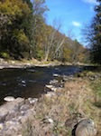
Against my better judgement I took a ride up to check out Clarks Creek. I was there from 12:30 PM to 2:30 PM. The air temp was between 84 and 90 F according to my car's thermometer, but it didn't really feel that warm because unless you were in the woods there was quite a breeze. It was that breeze that chased me away from Memorial Lake SP and the Susquehanna at Fort Hunter.
I stopped at the parking area at Bierly's Grove, I think that's the right name and walked about 75 yards of the stream looking for any insects or fish activity. I saw nothing going on. I moved up to the Sawmill parking area and again saw nothing. I figured, may as well go to the AT crossing.
There I ran into a couple of fellows fly fishing without much luck. The one guy came up the bank to talk to me and once he did several fish started rising. It was hard to tell exactly what they were taking but I suspect they were feeding on caddis because some could be seen hovering over the water and rises were like missile launches. There were a few smaller mayflies flying about, but none were caught and ID'ed.
As luck would have it today, I set out to spin fish for crappies and smallmouth and I took the wrong gear bag. I had nothing but spinning gear, but I had fly rods with me with no reels or flies. Looking at the stream, it was in fishable condition and a little low but even if I had a fly reel and flies, I wouldn't have bothered, except for maybe at Bierly's Grove.
The stream at the AT parking lot is nothing but a jumbled mass of dead trees. Twenty years ago, you could walk 1/2 mile downstream from the parking lot and enter the water and fish back upstream. If you were patient, you could spend 3 or 4 hours picking off trout from every likely hiding place on the way back. Thirty fish was a bad day in that stretch, and many of them were wild browns and natives. Today, you'd need a drone to dap flies on the open pockets of water between the log jams.
Regards,
Tim Murphy 🙂


Against my better judgement I took a ride up to check out Clarks Creek. I was there from 12:30 PM to 2:30 PM. The air temp was between 84 and 90 F according to my car's thermometer, but it didn't really feel that warm because unless you were in the woods there was quite a breeze. It was that breeze that chased me away from Memorial Lake SP and the Susquehanna at Fort Hunter.
I stopped at the parking area at Bierly's Grove, I think that's the right name and walked about 75 yards of the stream looking for any insects or fish activity. I saw nothing going on. I moved up to the Sawmill parking area and again saw nothing. I figured, may as well go to the AT crossing.
There I ran into a couple of fellows fly fishing without much luck. The one guy came up the bank to talk to me and once he did several fish started rising. It was hard to tell exactly what they were taking but I suspect they were feeding on caddis because some could be seen hovering over the water and rises were like missile launches. There were a few smaller mayflies flying about, but none were caught and ID'ed.
As luck would have it today, I set out to spin fish for crappies and smallmouth and I took the wrong gear bag. I had nothing but spinning gear, but I had fly rods with me with no reels or flies. Looking at the stream, it was in fishable condition and a little low but even if I had a fly reel and flies, I wouldn't have bothered, except for maybe at Bierly's Grove.
The stream at the AT parking lot is nothing but a jumbled mass of dead trees. Twenty years ago, you could walk 1/2 mile downstream from the parking lot and enter the water and fish back upstream. If you were patient, you could spend 3 or 4 hours picking off trout from every likely hiding place on the way back. Thirty fish was a bad day in that stretch, and many of them were wild browns and natives. Today, you'd need a drone to dap flies on the open pockets of water between the log jams.
Regards,
Tim Murphy 🙂