Fished some of the fly fishing section. Two fish, one attacked a stimulator as a dry dropper and one on a flashback pheasant tail. That stream is just full of downed trees that make it so difficult to fish. I know there have been posts here about it but it's just terrible.

You are using an out of date browser. It may not display this or other websites correctly.
You should upgrade or use an alternative browser.
You should upgrade or use an alternative browser.
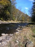
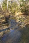
Clarks Creek, Dauohin County. 10-18-22
- Thread starter Billr
- Start date

Fish Sticks
Well-known member
Yea whats good for the stream isn’t always good for the fishing. Just like all those swaying cress beds in big spring can give fly fishers fits.Fished some of the fly fishing section. Two fish, one attacked a stimulator as a dry dropper and one on a flashback pheasant tail. That stream is just full of downed trees that make it so difficult to fish. I know there have been posts here about it but it's just terrible.
McSneek
Well-known member
- Joined
- Apr 12, 2011
- Messages
- 2,369
Huge difference between the cress beds on Big Spring and the fallen hemlocks on Clark’s Creek. As I’ve said before, if someone intentionally dammed a stream up like that people would be up in arms.Yea whats good for the stream isn’t always good for the fishing. Just like all those swaying cress beds in big spring can give fly fishers fits.
Fish Sticks
Well-known member
They both make fishing harder but provide habitat for the trout. Tyler Neimond at PA fish and boat has confirmed specifically for clarks they are beneficial. This pretty much addresses this topic.Huge difference between the cress beds on Big Spring and the fallen hemlocks on Clark’s Creek. As I’ve said before, if someone intentionally dammed a stream up like that people would be up in arms.
McSneek
Well-known member
- Joined
- Apr 12, 2011
- Messages
- 2,369
This article says nothing about Clark’s Creek. Dragging a 30 foot spruce tree into an 85 foot wide section of stream is nothing like the dams that have been created in Clark’s Creek. I stopped fishing Clark’s long ago. It’s not worth the time and effort.They both make fishing harder but provide habitat for the trout. Tyler Neimond at PA fish and boat has confirmed specifically for clarks they are beneficial. This pretty much addresses this topic.
Fish Sticks
Well-known member
A few things will happen with those dams. Either, as mentioned in the article, erosion may happen in the short term which unless that is occurring around infrastructure or property the article argues let it lay. The article did not assess clarks, the author did. Daniel Rae from pennstate extension who is their large woody debris expert was also contacted on this matter and we were actually about to give an in person presentation to address clarks and the benefits of the LWD up at the Pennstate extension building near rt 325 but then covid hit. erosion happens and the stream can change coarse around the jam and an island is created(side channels excellent juvenile habitat). Also water can sometimes down well in front of these islands and upwell in back which can hell stream temps. Or another thing is they can wash out to the side of the stream and then its the kind of large woody debris we all feel warm and fuzzy about on the inside again because we can fish it. Beavers make dams like this that can be good for the stream and create beaver meadows. They don’t behave the same way a concrete sam does in my understanding.This article says nothing about Clark’s Creek. Dragging a 30 foot spruce tree into an 85 foot wide section of stream is nothing like the dams that have been created in Clark’s Creek. I stopped fishing Clark’s long ago. It’s not worth the time and effort.

TimMurphy
Well-known member
- Joined
- Sep 9, 2006
- Messages
- 4,449
Dear McSneek,This article says nothing about Clark’s Creek. Dragging a 30 foot spruce tree into an 85 foot wide section of stream is nothing like the dams that have been created in Clark’s Creek. I stopped fishing Clark’s long ago. It’s not worth the time and effort.
Clarks is nothing more than silt pits anymore. That's too bad as even after the floods in 2004 and 2006 that dropped a lot of trees it was still fishable. But subsequent floods have just created huge piles of diseased felled trees that block any reasonable passage along the stream.
One day when the bridge on Rte 225 gets wiped out it may be fishable again.
Regards,
Tim Murphy
Fish Sticks
Well-known member
Over widened channels slow down stream flow and deposit sediment causing channel aggradation large wood or not. Trout passage is likely not impaired like with a concrete dam, the few remaining native brook trout in there evolved with beavers.
All the wood does is draws your attention to the upstream side where sediment piles up. But if you look on the backside of these jams there is actually clean gravel + evidence of ground water upwelling(certain plants) which are the two very important things for reproduction. Also keep in mind “we” did this and its in a transition point that could take over a century. Its not pretty but if we get in there with chainsaws like has sadly happened in other places its back to square one. I get its hard to fish and thats a different issue I don’t have answer for but fishing and conservation often haven different goals.
All photos from clarks behind large woody debris


All the wood does is draws your attention to the upstream side where sediment piles up. But if you look on the backside of these jams there is actually clean gravel + evidence of ground water upwelling(certain plants) which are the two very important things for reproduction. Also keep in mind “we” did this and its in a transition point that could take over a century. Its not pretty but if we get in there with chainsaws like has sadly happened in other places its back to square one. I get its hard to fish and thats a different issue I don’t have answer for but fishing and conservation often haven different goals.
All photos from clarks behind large woody debris
A few things will happen with those dams. Either, as mentioned in the article, erosion may happen in the short term which unless that is occurring around infrastructure or property the article argues let it lay. The article did not assess clarks, the author did. Daniel Rae from pennstate extension who is their large woody debris expert was also contacted on this matter and we were actually about to give an in person presentation to address clarks and the benefits of the LWD up at the Pennstate extension building near rt 325 but then covid hit. erosion happens and the stream can change coarse around the jam and an island is created(side channels excellent juvenile habitat). Also water can sometimes down well in front of these islands and upwell in back which can hell stream temps. Or another thing is they can wash out to the side of the stream and then its the kind of large woody debris we all feel warm and fuzzy about on the inside again because we can fish it. Beavers make dams like this that can be good for the stream and create beaver meadows. They don’t behave the same way a concrete sam does in my understanding.
If anyone does a presentation or has an article about the physical habitat situation on Clarks Creek, I would be very interested in hearing/reading it. I'm very familiar with large woody debris and fluvial geomorphology topics generally, but I'd be very interested in any analysis specifically of the situation on Clarks Creek.
One thing I noticed is that the banks are very high and the floodplain material is very sandy. I'd be interested to know what opinions are about the causes of this. Is the floodplain elevation normal and the stream is seriously incised, and if so what caused that? Or, was there significant floodplain aggradation from "legacy sediment" and if so what caused that? Or is it a combination of both?
What is the history? Was the stream straightened/channelized in the past? Were they any dams in that stretch?
Fish Sticks
Well-known member
I agree, I would love to see what a fluvial geomorphologist thinks about clarks too. Just for the purpose of knowing where the stream is heading meander geometry/planform wise in the future. Essentially we know the wood is in there and the stream is slowly correcting itself but what is it “trying to do exactly”.If anyone does a presentation or has an article about the physical habitat situation on Clarks Creek, I would be very interested in hearing/reading it. I'm very familiar with large woody debris and fluvial geomorphology topics generally, but I'd be very interested in any analysis specifically of the situation on Clarks Creek.
One thing I noticed is that the banks are very high and the floodplain material is very sandy. I'd be interested to know what opinions are about the causes of this. Is the floodplain elevation normal and the stream is seriously incised, and if so what caused that? Or, was there significant floodplain aggradation from "legacy sediment" and if so what caused that? Or is it a combination of both?
What is the history? Was the stream straightened/channelized in the past? Were they any dams in that stretch?
TimMurphy
Well-known member
- Joined
- Sep 9, 2006
- Messages
- 4,449
Dear troutbert,If anyone does a presentation or has an article about the physical habitat situation on Clarks Creek, I would be very interested in hearing/reading it. I'm very familiar with large woody debris and fluvial geomorphology topics generally, but I'd be very interested in any analysis specifically of the situation on Clarks Creek.
One thing I noticed is that the banks are very high and the floodplain material is very sandy. I'd be interested to know what opinions are about the causes of this. Is the floodplain elevation normal and the stream is seriously incised, and if so what caused that? Or, was there significant floodplain aggradation from "legacy sediment" and if so what caused that? Or is it a combination of both?
What is the history? Was the stream straightened/channelized in the past? Were they any dams in that stretch?
There is no legacy sediment to speak of in Clarks Valley. The stream sits on a valley floor consisting of pine trees and sandstone. There has been virtually no agriculture in the valley in history, except for a few patches near the headwaters. Lancaster County it ain't. In truth, it is a pretty inhospitable place.
The stream has the gradient of a dive bar pool table with the book of matches missing from under the one corner leg. If not for the DeHart Dam and the pine canopy it would be a big warm wide sandy wash given the last 15 years' worth of floods.
Regards,
Tim Murphy 🙂


silverfox
Well-known member
- Joined
- Oct 4, 2006
- Messages
- 1,928
Looks like a ton of good trout habitat to me. What's the problem here? Nobody does the ol sculpin dingle dangle in log jams round here? 🤣Over widened channels slow down stream flow and deposit sediment causing channel aggradation large wood or not. Trout passage is likely not impaired like with a concrete dam, the few remaining native brook trout in there evolved with beavers.
All the wood does is draws your attention to the upstream side where sediment piles up. But if you look on the backside of these jams there is actually clean gravel + evidence of ground water upwelling(certain plants) which are the two very important things for reproduction. Also keep in mind “we” did this and its in a transition point that could take over a century. Its not pretty but if we get in there with chainsaws like has sadly happened in other places its back to square one. I get its hard to fish and thats a different issue I don’t have answer for but fishing and conservation often haven different goals.
All photos from clarks behind large woody debris
View attachment 1641227420View attachment 1641227421View attachment 1641227422View attachment 1641227423View attachment 1641227424
laurelrun
Active member
- Joined
- Mar 7, 2014
- Messages
- 348
I've had great days fishing Clarks over the years. It does get tough. But I've walked the fly section and seen one of those blow downs with trout stacked under the logs like soldiers in a chow line. They are hard to fish to, but the fish don't seem to mind.
Fish Sticks
Well-known member
Like silverfox said show em the dangle and LWD will be your best friend.
Dear troutbert,
There is no legacy sediment to speak of in Clarks Valley. The stream sits on a valley floor consisting of pine trees and sandstone. There has been virtually no agriculture in the valley in history, except for a few patches near the headwaters. Lancaster County it ain't. In truth, it is a pretty inhospitable place.
The stream has the gradient of a dive bar pool table with the book of matches missing from under the one corner leg. If not for the DeHart Dam and the pine canopy it would be a big warm wide sandy wash given the last 15 years' worth of floods.
Regards,
Tim Murphy 🙂
"Legacy sediment" just means man-caused deposition on top of the original floodplain. It is not limited to agricultural areas. There are many places in "Big Woods Country" where logging boom era dams have caused "legacy sediment" deposits on the floodplains.
I know a place in Clearfield County where a former dam caused deposition of 6 feet of sandy material on top of the original floodplain. The floodplain aggradation continues upstream for about 1 mile.
I don't know what caused the incised, high banks situation on that section of Clarks Creek. But IMHO that was man caused, not a normal geological situation. The banks there are about 5-6 feet high.
I found this article that describes Victoria Furnace, an old iron operation, and says it harnessed the water of Clarks Creek. Those old iron furnaces were water powered and always had dams.
Does anyone where the old dam was?
It's been awhile, but as I recall, Clarks Creek further upstream, near the Appalachian Trail crossing, does not have such high banks. The stream and floodplain looked more normal up there.
Last edited:
This supposedly shows the approximate location of Victoria Furnace.
My hypothesis is that there was a dam on Clarks Creek that powered the iron furnace, and that caused several feet of floodplain aggradation (legacy sediment), which is why the banks are so high in the lower end of the special regs area. The stream is incised into that sediment, and confined between the high banks, which is one of the main reasons the physical habitat is poor.
My hypothesis is that there was a dam on Clarks Creek that powered the iron furnace, and that caused several feet of floodplain aggradation (legacy sediment), which is why the banks are so high in the lower end of the special regs area. The stream is incised into that sediment, and confined between the high banks, which is one of the main reasons the physical habitat is poor.
TimMurphy
Well-known member
- Joined
- Sep 9, 2006
- Messages
- 4,449
Dear troutbert,"Legacy sediment" just means man-caused deposition on top of the original floodplain. It is not limited to agricultural areas. There are many places in "Big Woods Country" where logging boom era dams have caused "legacy sediment" deposits on the floodplains.
I know a place in Clearfield County where a former dam caused deposition of 6 feet of sandy material on top of the original floodplain. The floodplain aggradation continues upstream for about 1 mile.
I don't know what caused the incised, high banks situation on that section of Clarks Creek. But IMHO that was man caused, not a normal geological situation. The banks there are about 5-6 feet high.
I found this article that describes Victoria Furnace, an old iron operation, and says it harnessed the water of Clarks Creek. Those old iron furnaces were water powered and always had dams.
Does anyone where the old dam was?
It's been awhile, but as I recall, Clarks Creek further upstream, near the Appalachian Trail crossing, does not have such high banks. The stream and floodplain looked more normal up there.
The Victoria Furnace was located well below the lower limit of the FFO stretch. The furnace ceased operation in 1857. I have no idea when the dam was removed but it likely happened well before I was born. If i had to hazard a guess I'd say the flood of 1936 took care of it.
Bailey's Grove is near the location of the old Victoria Furnace. Both are above the location of the CO-OP hatchery and the Childrens Stretch on Clarks Creek about 1/2 mile above the Rte 225 bridge. https://www.pennlive.com/pa-sportsman/2014/06/clarks_valley_tract_dedicated.html
It is well below the lower limit of the FFO only stretch. Knowing that the iron works were both on Clarks Creek and Stony Creek, and knowing that dam on Stony Creek still stands I can't imagine that the Victoria Furnace Dam was much larger?
Clarks is an extremely low gradient stream. DeHart Dam since its completion has done a pretty good job of protecting the stream and the people downstream. But we have had several floods in the past 15 years that have topped DeHart Dam and let the full volume of water flow downstream.
The first few had little effect on Clarks from the FFO stretch to the dam. Yes, trees fell, and yes, they often crossed the stream. But they were few and far between. In the early 2010's, Wolly Adelgids infested the area hard, and killed many trees. They killed 5 in my little .6 of an acre backyard. Imagine how many hundreds or thousands they killed in Clarks Valley?
Subsequent floods have dropped those dead trees all throughout the valley from the Appalachian Trail lot on downstream. Each flood rearranges the woodpiles a bit, but one day the flood will come that takes them all out at once. In the meantime, the stream has been rendered largely unfishable.
Regards,
Tim Murphy
Dear troutbert,
The Victoria Furnace was located well below the lower limit of the FFO stretch. The furnace ceased operation in 1857. I have no idea when the dam was removed but it likely happened well before I was born. If i had to hazard a guess I'd say the flood of 1936 took care of it.
Bailey's Grove is near the location of the old Victoria Furnace. Both are above the location of the CO-OP hatchery and the Childrens Stretch on Clarks Creek about 1/2 mile above the Rte 225 bridge. https://www.pennlive.com/pa-sportsman/2014/06/clarks_valley_tract_dedicated.html
It is well below the lower limit of the FFO only stretch.
The PFBC regs booklet lists the boundary of the special regs section as 2.4 miles, PGC rifle range parking area on SR 325 downstream to PGC access road at the Iron Furnace.
Also the map link I posted shows Victoria Furnace near the lower end of the special regs area.
The website I posted places the Victoria Furnace as 0.3 mile below the access road that crosses the bridge, at the lower end of the regs area.
And there is a sign at one of the parking areas in that area about Victoria Furnace.
I remember seeing the old furnace stack and piles of slag somewhere around there years ago.
Once you locate the old furnace stack, if you walk upstream you should be able to tell where the dam was located. In some cases the dam was immediately upstream from the iron works. But in other cases the dam was further upstream, and a mill race ran from the dam down to the iron works.
Where dams were removed, sometimes you will see remnants of large rocks and/or timbers. But even if those are not present, you should be able to tell the location of the former dam by looking at the floodplain elevation change, where it goes from a low floodplain to a high floodplain, with high banks, caused by deposition behind the former dam.
Last edited:
Matt_Geiman
Member
- Joined
- Dec 20, 2019
- Messages
- 40
Has anyone been on Clarks recently, give an update on the water level?
Thanks!
Thanks!