
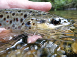
Big Spring Creek and Falling Spring Branch, Cumberland/Franklin Counties, 5/23/25

There's a way we can find out for sure if Spring Creek water levels have been dropping. Check the historical data on USGS Spring Creek going way back. It requires some effort, and I did it a few years ago to settle a bet. ( I'd do it again if I had the time but I don't right now.)

I found that, on average, the volume of water has NOT decreased going back into the late 50's. In fact--and things may have changed recently-- the lowest water period was in the 60s.

If anyone wants to, they can check it out. Punch in the right parameters on the USGS site and do some mean averaging.

Selective memory is a tricky thing. I thought for sure it would show a drop in levels over the decades. I was wrong.

 
There's a way we can find out for sure if Spring Creek water levels have been dropping. Check the historical data on USGS Spring Creek going way back. It requires some effort, and I did it a few years ago to settle a bet. ( I'd do it again if I had the time but I don't right now.)

I found that, on average, the volume of water has NOT decreased going back into the late 50's. In fact--and things may have changed recently-- the lowest water period was in the 60s.

If anyone wants to, they can check it out. Punch in the right parameters on the USGS site and do some mean averaging.

Selective memory is a tricky thing. I thought for sure it would show a drop in levels over the decades. I was wrong.
Dear greeghost,

Perhaps someone can explain why there are trees growing in what used to the stream bed then. The stream is definitely smaller especially through the Paradise section. You can clearly see that, in fact you can easily see the drop off in the land immediately adjacent to the current stream bed. There is now a step down filled with riparian buffer where there used to be flowing water. All those trees that are growing by the main bridge to the hatchery where the picnic table is today didn't exist back then as it was all flowing water. The Paradise section isn't the only section of the stream where this has happened. Spring Creek has physically narrowed over much of its length since the late 1970's.

Regards,

Tim Murphy 🙂
 
No doubt water withdraws from the aquifer have impacted our spring creeks. The drastic low water present in the CV streams near me, however, is at least partially due to the drought that we are currently crawling out of.

There is a lag between rainfall and spring discharge in karst geology, so while they may be running low now, there should hopefully be some rebound in the next several months as the recharge moves through the system.
 
No doubt water withdraws from the aquifer have impacted our spring creeks. The drastic low water present in the CV streams near me, however, is at least partially due to the drought that we are currently crawling out of.

There is a lag between rainfall and spring discharge in karst geology, so while they may be running low now, there should hopefully be some rebound in the next several months as the recharge moves through the system.
I sure hope so. I haven't been to the letort fly only section in a hot minute but big spring and especially falling spring are just pitiful to look at in certain stretches. Some of the smaller lesser known ones are even worse
 
Dear greeghost,

Perhaps someone can explain why there are trees growing in what used to the stream bed then. The stream is definitely smaller especially through the Paradise section. You can clearly see that, in fact you can easily see the drop off in the land immediately adjacent to the current stream bed. There is now a step down filled with riparian buffer where there used to be flowing water. All those trees that are growing by the main bridge to the hatchery where the picnic table is today didn't exist back then as it was all flowing water. The Paradise section isn't the only section of the stream where this has happened. Spring Creek has physically narrowed over much of its length since the late 1970's.

Regards,

Tim Murphy 🙂
Tim, I don't know the answer to your questions. All I know is the numbers on the USGS site don't support a drop in water volume - at least they didn't last time I checked (could have been like 10 years ago). I first fished the Paradise back in the late 70's when Joe Humphreys took us there on a field trip. I honestly don't remember the water being higher back then. But then again, these days I'm lucky to remember my name. lol When I get the chance, I'm going to see if I can run the USGS numbers again.
 
Last edited:
Back
Top

