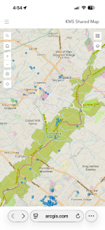
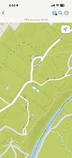
The arcgis maps for the WEB are great, and the map I posted has many useful details that none of the mobile apps I’ve tried include (fishbrain, troutroutes, onx hunt, onwater, and few others i can’t remember). The maps always display stream names and feature far more streams, stream information, public trails, gameland roads, and both verified and potential parking locations.
However, after a month of regular use, I’ve concluded that the current arcgis fields maps APP is a DISASTER. It launches background activities that cannot be disabled that render both itself and MANY other apps my iPhone 16 Pro Max nearly unusable. This has apparently been known for almost a year since version 25.2 was released (current is v26.1.2), but unfortunately arcgis doesn’t seem in any great hurry to fix it.
I have a nearly 10 year old iPad Pro that works perfectly because it won’t update past v25.1, so if you happen to have one of those go for it. Otherwise, skip the APP. So much for navigable maps. 🤦🤷