You are using an out of date browser. It may not display this or other websites correctly.
You should upgrade or use an alternative browser.
You should upgrade or use an alternative browser.
Little Juniata
- Thread starter Chetty82
- Start date
- Joined
- Sep 9, 2006
- Messages
- 17,385
I was told by a "reliable source" that mapping companies sometimes publish purposeful inexactitudes in order to make it easier to prove copyright violations. If all maps were 100% accurate, it would be impossible to protect one's copyright. It makes perfect sense, though I don't believe it for a moment. Or do I?
littlejuniata
Active member
- Joined
- Sep 16, 2006
- Messages
- 1,743
are we getting maps made in China now?? I sometimes believe the Chinese guys purposey try to P off the American consumer
FiveWeight
Member
- Joined
- May 29, 2008
- Messages
- 689
troutbert wrote:
Fishidiot wrote:
5WT,
There are three branches of the "juniata" river. The one that Chetty is talking about (despite the forum title) is technically the Raystown Branch, Juniata River - this is the tailrace below Raystown Lake for several miles. Where the confusion stems from is the the section up at Huntington. Further north near Petersburg, the Little Juniata River joins the Frankstown Branch, Juniata River and this forms the river that flows down through Huntington. On my Delorme Map, this stretch is still labeled Little Juniata River. Most locals I have talked to however simply call it "juniata" and this helps differentiate it from the upstream sections known for trout fishing. The Little Juniata River flows down thru Huntington and then joins the Raystown Branch Juniata (Point Access site) - from this point downstream it is simply the Juniata River.
The DeLorme is simply wrong. The waterway that flows through Huntington is the Juniata River.
The USGS is the agency with the responsibility with maintaining geographical names and that's the way they list it.
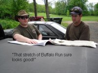
The DeLorme is usually correct, but not always. In the recent edition of the DeLorme, look at Spring Creek a short distance above Bellefonte. They have it labeled as Buffalo Run. That error was not in the earlier editions of the DeLorme.
Sooo where does it change from being the Little J to just the J? At the Frankstown Branch? Guys, I just wanna know what to call the water way that my camp is on.... I can't believe what the locals say.... I can't believe DeLorme..... Can I believe USGS? "littlejuniata" chime in on this, your a local up there. What say you?
Chetty82
Member
- Joined
- Apr 26, 2009
- Messages
- 251
ok the little juniata comes from up around spruce creek and the juniata river when I google earthed it comes from up around altoona that runs through alexandria join up on river road at the bridge which is just outside the town of alexandria and runs out into the raystown branch. Shavers creek, the little j, and stone creek all empty into the juniata from what I have seen before hitting up the raystown branch. Unless I am completely wrong then please let me know.
Chetty,
What 5WT wants to know is: What is the correct name for the section of river which runs from Alexandria (where the Little Juniata and the Frankstown Branch join) down through Huntington down to the confluence with the Raystown Branch. We know the names above Alexandria and we know the name below the Raystown branch confluence (simply "Juniata River"). The section in question is several miles. Troutbert claims it should be known simply as "Juniata River" through this stretch as well and I'm willing to accept that. Again, locals I have talked to typcially know this stretch as "Juniata River."
What 5WT wants to know is: What is the correct name for the section of river which runs from Alexandria (where the Little Juniata and the Frankstown Branch join) down through Huntington down to the confluence with the Raystown Branch. We know the names above Alexandria and we know the name below the Raystown branch confluence (simply "Juniata River"). The section in question is several miles. Troutbert claims it should be known simply as "Juniata River" through this stretch as well and I'm willing to accept that. Again, locals I have talked to typcially know this stretch as "Juniata River."

FiveWeight
Member
- Joined
- May 29, 2008
- Messages
- 689
Well again, thanks to all who jumped into this thread. But I'll be darned if I'm gonna argue with any of the locals up there regardless of what they call that stretch of water but from here on out I'll call it the "Juniata". Now where exactly does Stone creek become Standing Stone?....... Just kid'n here guys. I had enough stream geography for a little while. I can't hardly believe "littlejuniata" didn't jump in on this.... Matter of fact I can't say I've seen posts like normal from him here lately. Maybe outta town. Hope he's do'n alright. Again, thanks to all.
littlejuniata
Active member
- Joined
- Sep 16, 2006
- Messages
- 1,743
Been in bed with the flu since Sunday. The Juniata is formed at the junction of the Frankie and the Littlle Juniata near the high school,it retains that name through to above Harrisburg


