Fishing map

FFChineseman

FFChineseman

Member
Joined
Jul 21, 2009
Messages
102
Does anyone of you use a fishing map? if yes, which one you think is the best? I am thinking to purchase one and keep track of how much water I have covered. Would like to know what you guys think!!! :pint:
 
I'm too lazy to break away from the same 1/2 mile of stream...
 
You can create and save your own Fishin' Map on Google. Just click on "My Maps" and create it.


View Fishing Map in a larger map
 
I have a Delorme and use it for finding streams.
It has an optional gps that marks where you travelled.

I usually only use it when I feel adventurous or when i move to a different location.

I pretty much have all my favorite spots mapped out in my head.

There are plenty of free maps on the internet however and if you have a smart phone you can take them anywhere.
(I have to resort to taking my laptop and the delorme)
 
The reason i though about purchasing a map is becasue I will have to spend the thanksgiving holiday in the Pocono, and I would like to fish some little mountain streams. I was trying to use Google map, but it is very general without too much details.

PA A&G seems a good chioce, what version you have? I read about the review for the 10th verson (2007) and sounds like the 10th one is not as good as prior versions.
 
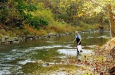
I have always enjoyed fishing Big Bushkill Creek in the Ressica Falls Boy Scout Camp. It's in Monroe County.
 

Attachments

  • Big Bushkill Creek.jpg
    Big Bushkill Creek.jpg
    16.3 KB · Views: 3
FFChineseman wrote:
The reason i though about purchasing a map is becasue I will have to spend the thanksgiving holiday in the Pocono, and I would like to fish some little mountain streams.[color=FF0000] I was trying to use Google map, but it is very general without too much details. [/color]

PA A&G seems a good chioce, what version you have? I read about the review for the 10th verson (2007) and sounds like the 10th one is not as good as prior versions.


The Delorme map is a good thing to have in your car, but Google maps are not "general" but very detailed. You can zoom in on your exact fishing spot with the satellite photos. Using the "terrain" view, the stream names appear on the map and you can zoom in for a closer look. Also you can mark your spots and save it on Google. Here's an example.


View Fishing Map in a larger map
 
I have an old Delorme Gazetteer and Atlas in the car and then I use google maps and the PennDOT Type 10 county and Type 5 township/borough maps to provide additional details. When going to a new place, I print several pages of maps of the area that will allow me to find the target stream and also Plans B-D waters nearby.
 
afishinado wrote:
FFChineseman wrote:
The reason i though about purchasing a map is becasue I will have to spend the thanksgiving holiday in the Pocono, and I would like to fish some little mountain streams.[color=FF0000] I was trying to use Google map, but it is very general without too much details. [/color]

PA A&G seems a good chioce, what version you have? I read about the review for the 10th verson (2007) and sounds like the 10th one is not as good as prior versions.


The Delorme map is a good thing to have in your car, but Google maps are not "general" but very detailed. You can zoom in on your exact fishing spot with the satellite photos. Using the "terrain" view, the stream names appear on the map and you can zoom in for a closer look. Also you can mark your spots and save it on Google. Here's an example.


View Fishing Map in a larger map

I've used Google and Microsoft map sat views to pick out riffles, parking spots, stream turns with deep pools, etc. I even found an underwater rock ledge on a reservoir that produced bass. Only issue is you should do your homework ahead of time since many remote areas don't have data access for smart phones.
 
I keep a DeLorme Pennsylvania Atlas and Gazettee in the car and use Google Maps to plan:
http://www.paflyfish.com/modules/smartsection/item.php?itemid=157
 
Thanks a lot folks....learned some good stuff today!!
 
I use google earth and bing maps online but Iv found the DeLorme maps to be the best. I highlighted all of the wild trout streams in the areas of PA I fish, very useful and more tangible than online maps.
 
afish,

How do you 'draw' on the GoogleMaps?
 
afish who wants to fish there it looks like its a bait area....lol
 
PM me and I'll put you on some good water.
 
Trout Streams of Pennsylvania by Dwight Landis is also an excellant resource. The book has maps, it references DeLorme by page number, and he gives detailed instructions to fishing areas. For example, he'll start you at an intersection and write something like drive 1.4 miles, turn left onto XXX rd, drive 1.1 mile over a RR track and look for a parking area. In some places he'll list businesses as landmarks to look for and tells you what to do when you find them (turn, park, whatever).
 
Cathy, I only read an earlier edition of Dwight's book. Is your's a newer edition. I'm wondering because I do not remember that much detail. I thought you were going to tell us he described what rock to stand behind to cast to the rootball at 38.265962,-85.623084. :cool:
 
wsender wrote:
afish,

How do you 'draw' on the GoogleMaps?


Dave Kile is the Map Master! Just click on the link he posted and follow his directions:

http://www.paflyfish.com/modules/smartsection/item.php?itemid=157

Give it a try. If you have any questions, just post them. Good luck.
 
Back
Top